
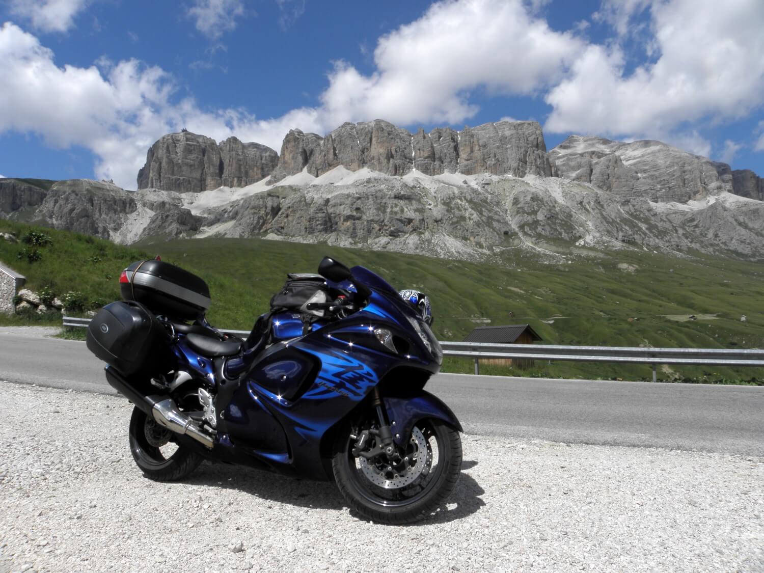
DAY 1. LET’S START
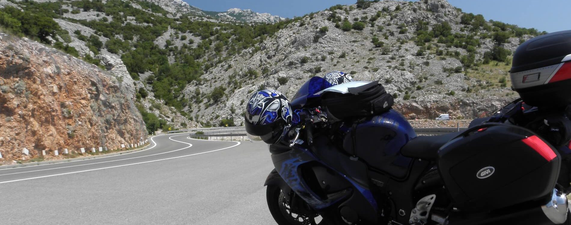
Ashby-de-la-Zouch, Anglia –> Lesseux, France (634 miles)
Another adventure appeared before us, so we began to draw from it in full. We woke up early, or rather very early in the morning as we got up at 1.00 am. The night was quite warm so the journey was going well. The drive to the ferry port passed without any problems, even though we knew that there might be some problems because of the ferry workers strike. It all ended up in not very long diversion and we arrived at the port ahead of time.
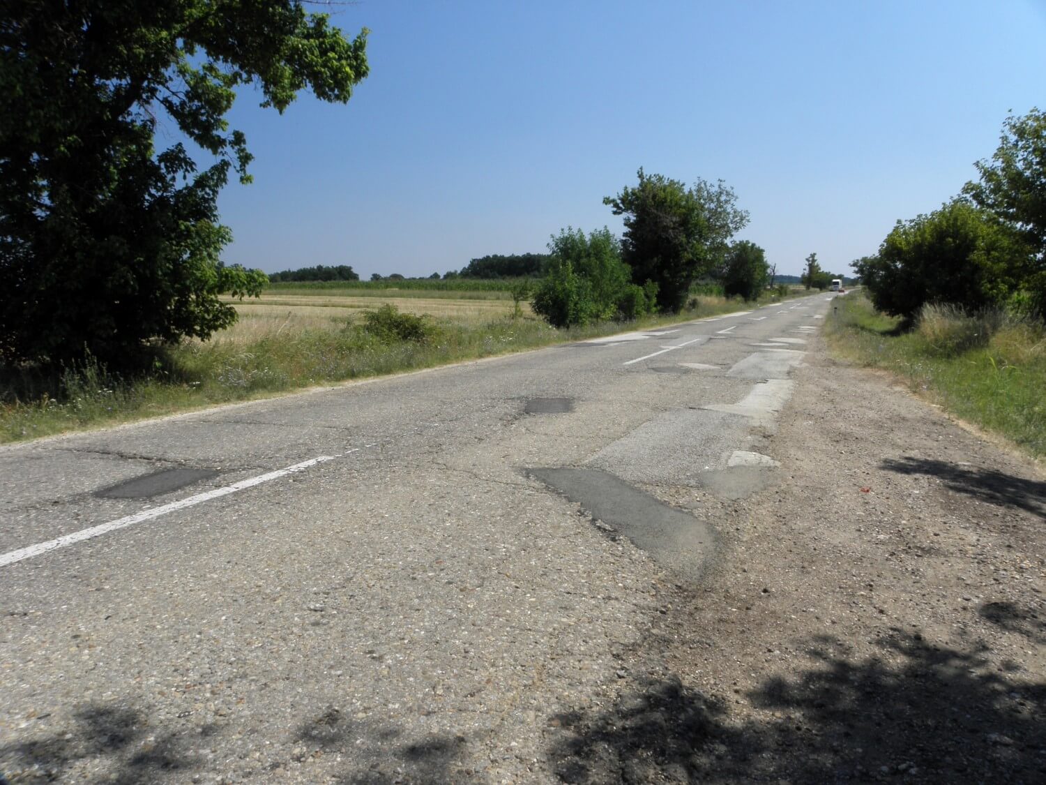
After we left the ferry, we got on to the A26 motorway and “we drove like crazy”. With every hour it was getting hotter, in the afternoon it was almost unbearable.
The motorways were set among sun-ripened rye, intersected in some places with green vegetation. The farther to the south such landscape gave way to the wooded hills. The end of the day brought, pleasant for the eyes, views of the road winding among woods. And all of this because of, or rather thanks to the diversion we had to follow.
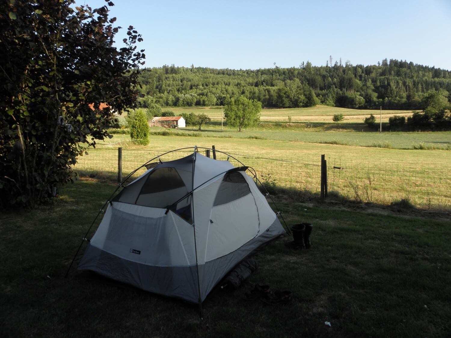 When we returned on the main route, we pulled over at the first campsite on our way. The owner turned out to be a very charming lady, who did not speak English but she was very talkative and wanted to help when we asked about the possibility of finding some food nearby. In the end we abandoned this option anyway and pleased ourselves with slices of “Królewski”cheese.
Even though we were up for 19 hours we did not feel that time and those miles we travelled. However when we lay down in a tent we fall asleep like children.
DAY 2. ROUTE DES CRÊTES
Lesseux, France –> Meiringen, Switzerland (271 miles)
The sun woke us up, there was blissful peace all around. So we packed up with no rush and set off. And then the problems began. We could not find the road we wanted to go, because we were looking for the wrong road number. We were looking for D430, and it turned out that we should first go onto D48 and D148. We were driving round and round, roamed around for about 1.5 hours before following our intuition we drove on to the right road. Our struggles have been compensated. Thanks to the views, comfort and pleasure of driving, we quickly forgot about the morning troubles. The drive was going very well, and the road was winding, smooth and wide. On the way we managed to eat a light breakfast at a roadside café.
 The road D430, so called Route des Crêtes is the essence of a pleasant journey. It is really worth to travel this route.
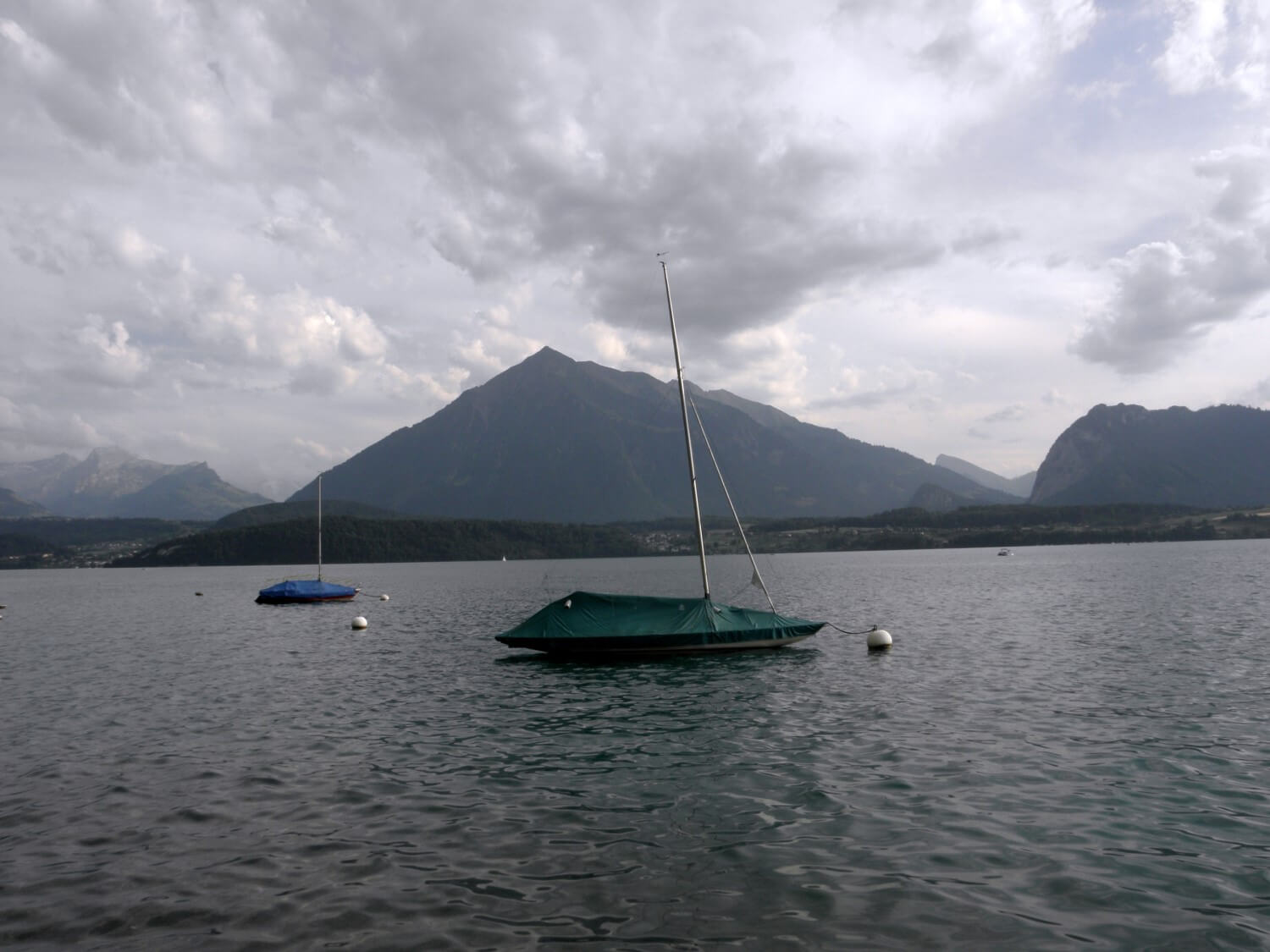
Next we headed towards the border with Switzerland. Following stunning roads (D437, D464) we crossed the border and arrived at Interlaken on the Thunersee Lake, which made great impression on both of us. Beautifully situated, wooden, solid Swiss houses, clean and neat, and stunning views of the surrounding hills and the lake. Picture like from a postcard. One would like to stay longer.
DAY 3. LOWSIDER TO THE LAKESIDE
Meiringen, Switzerland –> Corteno Golgi, Province of Brescia, Italy (259 miles)
In the morning we found out that we were fortunate when we chose a spot for our tent, i.e. under the trees. It rained at night, not too heavily but steadily, however we packed up almost dry tent thanks to the trees that took all the rain water in.
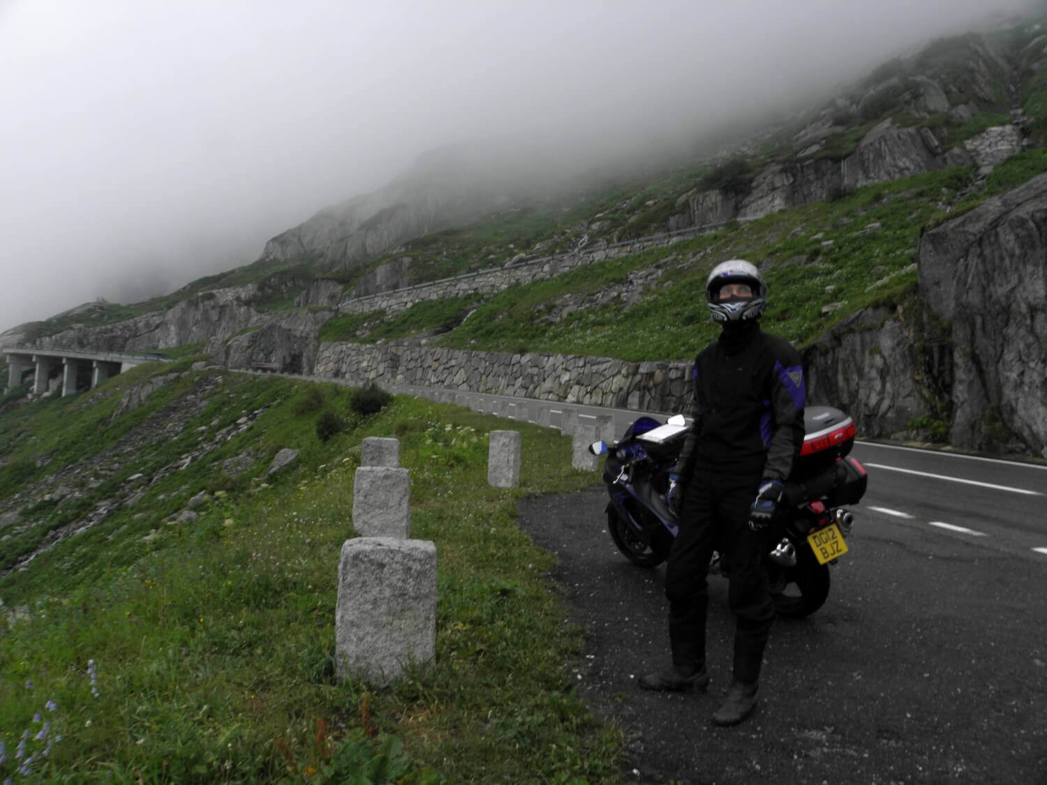 As it was still cloudy and raining we put on an extra layer of clothes before we started to ascend. Through the beautiful ravine we were driving in the direction of Brig, climbing higher and higher taking many hairpin turns. Before we realized it, we reached the Grimsel Pass. (From the bottom it looks as almost vertical wall). It was a pity that we could not enjoy it much, as the visibility dropped to a few meters on the pass itself, where there was still some snow. It started to clear only when we descended into the valley. There, we ate breakfast at a picnic table overlooking the GOMS Bridge pedestrian bridge suspended over the river canyon. Of course we took the pleasure in walking down that bridge, which made a great impression.
Next we headed towards Italy ascending the Simplon Pass. Excellent road to ride a motorcycle – smooth, flat, wide, and the views simply stunning. At the top we did not stay long as it was quite cold.
Although the border is only conventional, we could clearly sense the moment we entered Italy. The road surface got considerably worse. However the views were still delightful. We were driving through a beautiful gorge, along the river, where rock walls were almost touching the road which passed through tunnels at some places. We descended right into the valley, which we could sense in temperature, it got shockingly hot.
 The comfort of driving dropped significantly when we reached the Maggiore Lake. The road led through small towns, what slowed down the traffic which already has been extremely dense. The miles were hard going. That route made us very tired, enough to made decision to verify our itinerary for the day and instead of going to Lake Garda we headed towards the mountains.
For a moment we drove back to Switzerland, because the road led that way. And right there, on the road to Lugano, we had accident – minor lowside crash. Poor driving conditions, heavy traffic, heat and fatigue made themselves felt. A split of second was enough and we ended up on the ground. Fortunately the speed was virtually none, so we ended with abrasions and bruises only. When we decided that we all were fit to drive we set off slowly, you couldn’t drive faster anyway.
We were driving along yet another lake. Both lakes (Lugano and Como) are beautifully located, surrounded by wooded hills, with the charming villages and vineyards on the slopes – wonderful land.
Italian buildings captivated myself. We could watch them from each side moving on the roads that meandered between them. The characteristic roof tiles, wooden blinds, beautiful finishes – and all that in harmony with the surrounding landscape.
Next we headed in the direction of Sondrio following the road number S38, which led through a beautiful valley. As we were in Italy, we had pizza for the dinner. We finished our day driving up the Pass Aprica (1181m). There we stopped for the night.
SWITZERLAND – beautiful valleys, charming villages with wooden buildings harmonizing with the green slopes of the mountains – idyllic landscape
DAY 4. ACROSS THE DOLOMITES
Corteno Golgi, Province of Brescia, Italy –> Pulfero, Italy (306 miles)
As we spent the night in the mountains the morning was cooler. We packed up swiftly and went further the SS38 road, which provided excitements from the very morning. Although we were riding through beautiful valley, the drive wasn’t going well at first, because we had to drive behind a truck, which we could not overtake in any way. So we stopped at a picnic spot and had some yoghurt and fruits for our breakfast. Later the drive was going much better. We were heading east climbing Passo del Tonale (1883m) and moving along gorgeous valleys and canyons.
We turned into the road SS48 and the Dolomites welcomed us. The most beautiful route so far. As we already were driving at some height, the air was crispy clear and much cooler. Moreover some clouds appeared in the sky and driving become more pleasant as it was not so hot. The journey was comfortable and the road was excellent – pass followed by another pass, turn after turn. With every mile the Dolomites were uncovering their majestic views providing real treat for the eyes and soul.
 Just as we left Canazei we climbed to 2239m above sea level, up the Passo Pordoi. The views were as out of this world – panoramic view of the Dolomites range in all its glory. We were sorry to leave from there. The same was true on the next pass – Passo Falzarego (2105m).
The entire land of the Dolomites is a typical tourist area. All around you can see ski lifts, hotel towns and many tourists.
From Cortina d’Ampezzo we moved along S51 and S251 roads towards Udine, which led through marvellous gorge along the river and along the lake Lago di Barcis with truly amazing turquoise waters. It became quieter on the road and the drive was going just great. Soon we left the mountains, the terrain became more flat and now we could admire fruit plantations and farmlands. Unfortunately as it was a typical agricultural area, search for the campsite was in vain. We kept moving towards Slovenia. We entered the mountainous area again and it got quite late. Just before the border we saw the road sign pointing to a campsite. We were surprised when we saw it, or rather when it was shown to us. It turned out to be no longer in use, abandoned. Right next to it there was a restaurant, from where lady came out and explained that we can stay, that was not a problem. She opened the facilities for us; they were nicely finished, just dirty because were left without cleaning for long time. Even though the water was cold and there were many spiders, it did not make any difference for us. We had campsite for our exclusive use.
ITALY – charming churches beautifully situated on the hills, towering over towns, visible from far afar, emphasizing the multidimensionality of the landscape
NOTE – Italian drivers do not respect the speed limit and often disregarding the rule of priority, you have to drive with the double care
DAY 5. SWEET AND QUIET COUNTRYSIDE
Pulfero, Italy –> Čatrnja, Croatia (260 miles)
 We had some difficulties in waking up, as we went to bed quite late. We got up just before 8.00, packed up swiftly, gave our thanks to the lady, who did not want any money from us, and we set off towards the border with Slovenia. In the first town on our way we stopped to look at the map and because we spotted café nearby, we decided to eat proper breakfast. It was very nice.
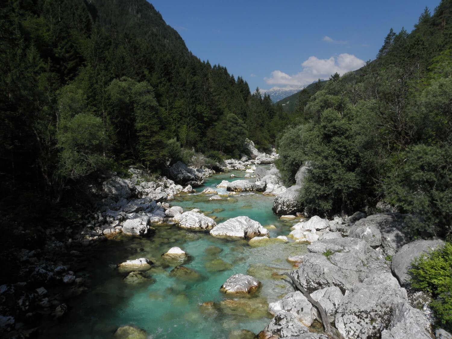
After that we moved towards the Julian Alps, climbing higher and higher. We got onto the road no. 206, driving along lovely situated stream with transparent clear and amazingly turquoise waters, over which morning mist still hovered. We stopped several times, it was so pretty there.
Then we got to the serpentines which led us to the highest pass in Slovenia – Vršič pass (1161m), where sheep and cows ruled, not bothered about the passing traffic and were grazing in the middle of the road not even thinking about moving off the road. Descent from the pass was of much worse quality (all the hairpin bends are slippery cobbled surface), but soon we got to Kranjska Gora, where we stopped to refuel.
 Next we headed to Bled, because I really wanted to see the famous church on the island. Unfortunately it didn’t go well. First mistakenly following the road signs to the castle we got to the castle…on the rock. We did not feel like visiting it, so we drove down to the lake. From there I could see the church on the water in the distance. However it differed from the views I was expecting… how many times I have been disappointed expecting something else…
As we did not have more planned visits in Slovenia, we purchased a vignette and got on to the motorway. Heading towards the border we passed an interesting route from Novo Mesto to Metlika leading through the hills and woods with lots of turns. The feels like temperature was now much higher as we left the high mountains.
Soon we were on the Croatian border. It was the first border crossing with check on our way. Fortunately there were no problems. In Croatia we got on to the road no 6 towards Karlovac, where we managed to withdraw some money and then we moved on to the Plitvička Jezera. On the way we stopped for a delicious and large meal in a roadside restaurant. Someone once said that where lorry drivers stop there is good food. And now as well as later on it has been confirmed :)
In Croatia we could see the decrease in the quality of roads, one grade lower in comparison to Slovenia. Unfortunately the quality of driving has also decreased; drivers ignore speed limits, overtaking when not safe to do so. For us, accustomed to a different culture of driving it caused a decrease in driving comfort; sometimes the situation on the road tired us out.
Finally we reached the area of lakes. We spent some time looking for campsite, because we wanted to be as close to the lakes as possible. Marcin had a small argument with the campsite staff, because they wanted to hold our passports for the night, which apparently is against the law. That left bad aftertaste. After the bath we did small laundry and quickly hide in the tent falling asleep like children.
ITALY – the closer to the border with Slovenia, you could see more poverty
SLOVENIA – it had the feeling of a very nice, quiet and tourist friendly country, beautifully located, clean, generally offering a very positive impression
CROATIA – a lot of abandoned houses, still unfinished, just raw, red brick; the cities resembled the Polish ones with billboards and ads at every turn
DAY 6. PLITVIČKA JEZERA
Čatrnja, Croatia –> Baška Voda, Croatia (260 miles)
We packed up a bit later than usual, and as soon as possible we went to the lakes. From the very morning there were so many people that there was already a queue for tickets, fortunately not too long. If we had to wait more in that already hot day, knowing that we would have to pay 360HRK (50€) for 2 tickets we would probably gave up on that place. Good though it did not happen, because this place is worth every penny we spent there.
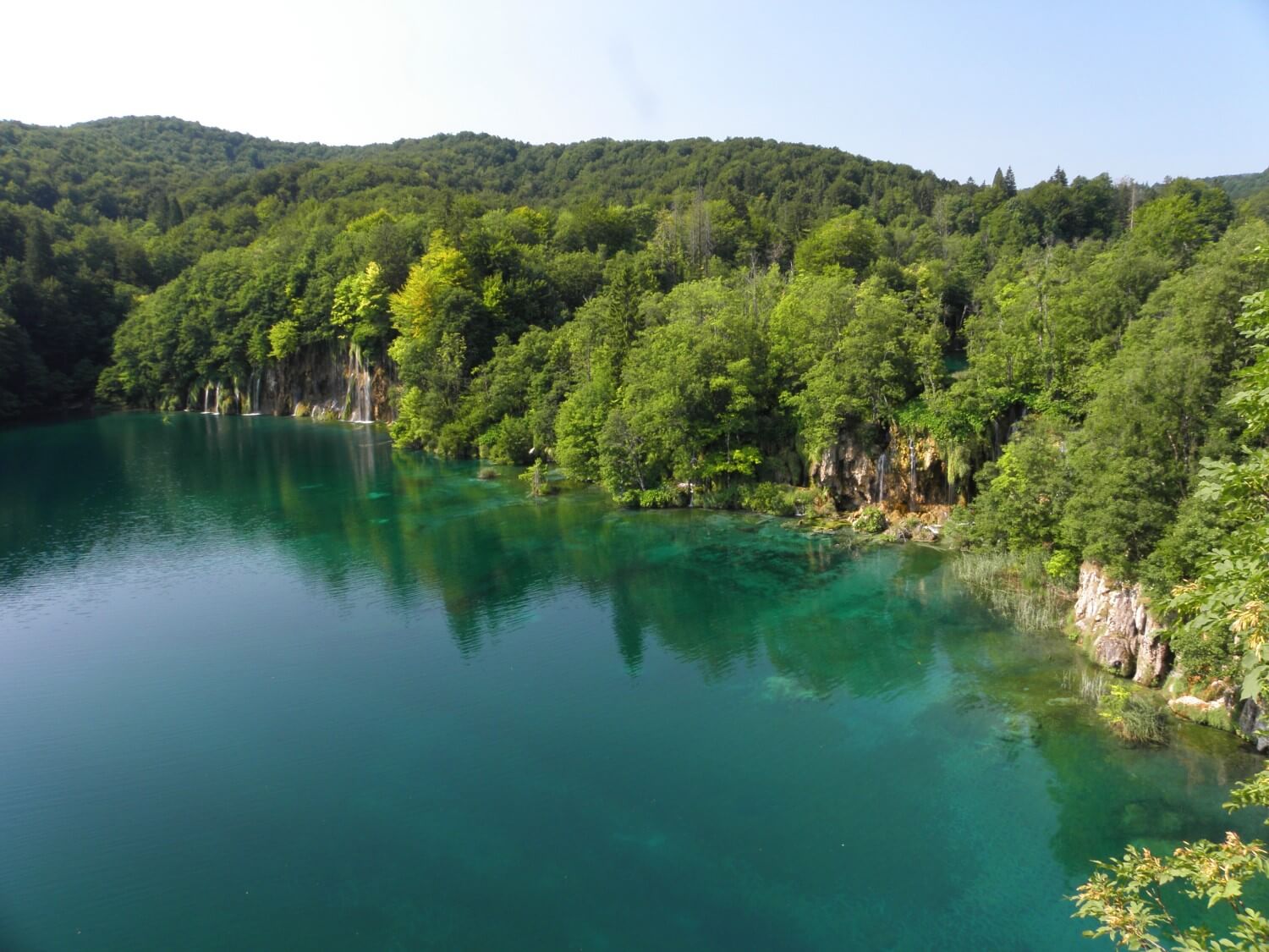 Plitvice Lakes connected by waterfalls cover a large area. Not knowing how to start the tour, unwittingly we got to the P1 point, from where, on the boat, we got across to the P2 point on the other side of the lake. From the first moment we were enchanted by this place, beautifully situated lake with incredibly clear waters. And that was just the beginning. We studied the map and decided to go further to the point St2 moving along the wooden walkways arranged along the lakes, sometimes passing over the waters connecting the lakes, near waterfalls, over streams and ponds. Everywhere flow incredibly crystal clear water. In small ponds, as well as lakes you could see immersed in water tree limbs and branches – it looked so great.
The path is routed in very interesting way and made in a way so it leads literally on the lake waters, between waterfalls, and then on the slopes near lakes. We enjoyed it so much that we decided to extend our walk and get to the point St3, and that was a total of almost 1.6 miles. We got there and returned by bus to our starting point. We were all wet, because it was sweltering unmercifully. Good though that the lakes are hidden in the woods, so it was at least cooler in the shade of trees.
Plitvice Lakes are worth seeing. It is best to start in the morning (it’s open from 7 in the season) and allow at least 4-5 hours, but preferably to go there for whole day. As we were in our motorcycle suites, we only slipped past, but we loved it and that image will stay in our memory for ever.
Note: During the summer season it’s very crowded there, sometimes the walk was bit unpleasant, because at some places you had to go in single file, and could not overtake or even stop for photo. However we knew that we could expect that as it’s a major tourist attraction in the area.
 Next we headed west, to get to the Adriatic Highway. We got on the road no 25 towards Karlobag, which was a splendid drive – smooth, twisted road, Croatian villages all around, fields and meadows…if only it was not so hot. The closer to Karlobag, it was getting more interesting. The road cut out in the rocky slopes of hills covered with big bushy vegetation. Everything around was extremely dry. In Karlobag we refuelled and moved on the famous road no 8. This part of the highway from Karlobag to highway to Zadar is the most beautiful. The road winds along the coast, surrounding coves, the orange-clay-grey rocks around washed by the incredibly turquoise clear water. The drive was a pure pleasure; the heat was not bothering us so much because we were too delighted by the views. I recommend this part of the Adriatic Highway to anyone – balm to motorcycle tyres;) It was so beautiful that we decided to succumb to charm of that place and we ate a delicious fish with fresh salad at a roadside restaurant overlooking the sea.
When we were nearing Zadar it became incredibly hot, there was almost no air to breathe and the sun was roasting mercilessly. Drive through Zadar was a torture, and further on it was not any better. We got into a tourist area so from one city we drove into another, the traffic was getting heavier, and there were many people everywhere. The drive tired us so much that we decided to bypass this piece of land by highway.
We left the highway heading to Makarska, and there we entered the so-called Makarska Riviera. The landscape has changed slightly; there were more trees, small gnarled evergreens, more hills around. It was already late so we stopped at the first campsite we spotted. It turned out to be a big holiday resort; we barely had space to set up the tent. Campsite was full of people, including many Poles, moreover it was loud and first and only time I had to wait in a queue for showers. In addition it got very stuffy and warm, and even the night did not bring any coolness. Those few things caused that the evening wasn’t a successful one, and the night was not any better as we had problems sleeping in such a high temperature.
CROATIA:
– parts of roads perfect for driving a motorcycle
– the coast is very popular tourist area and thanks to that much more expensive than the interior of the country, for today’s dinner we paid about 3 times more than for yesterdays
– here we first spotted stalls with fruits, which as it later turned out, are visiting card of the Balkans; people sell fruits, vegetables at roadside stalls all day long
– the characteristic marks are also ubiquitous and very noisy cicadas, (…), which were nowhere to be seen, but heard from afar; they give their characteristic sounds and sometimes cause sleep difficulties
DAY 7. DONKEY ZENEK
Baška Voda, Croatia –> Hum, Bosnia and Herzegovina (210 miles)
In the morning we packed up quickly and as soon as possible we left that unpleasant campsite. We followed further the Adriatic Highway to the south. The drive was quite good, because the sun, even though burning hot from early morning, from time to time it hid behind the hill and we drove in the shade. We could say that we were going swiftly as the road was excellent and the views the finest.
On the way we stopped at a roadside stall and bought a watermelon, some grapes, and in the nearest bakery also buns and bread rolls. So out of the blue we managed to arrange breakfast which we ate at the nearest picnic spot, hiding in the shade which was still there.
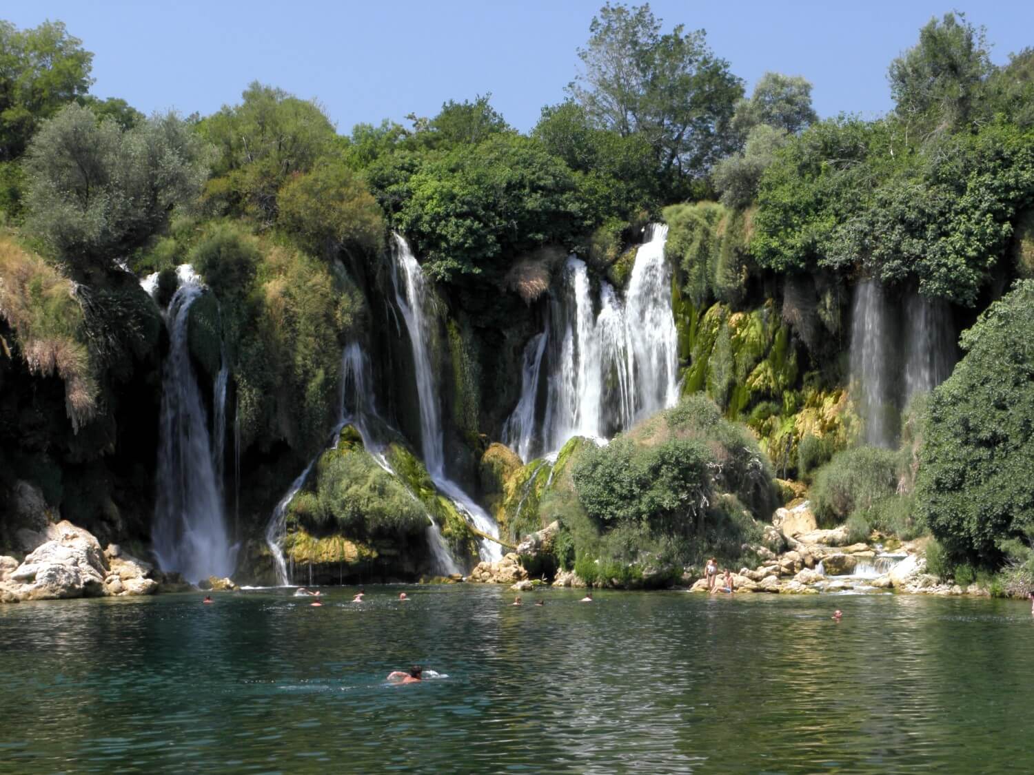 Next leaving the coast we headed towards the border with Bosnia and Herzegovina, which we crossed without any problems; we only had to by the insurance. It was already insanely hot, and when we started to drive further inland the heat became unbearable. In vain we were looking for the shade when the sun was so high in the sky. We headed towards Ljubuški, from where we reached the Kravica waterfall. It is in fact ordinary swimming place not viewing point. It was very nice and beautiful there. We did not stay there long, even though the cold water was tempting to jump in. It would be just difficult to get out of it. We also changed our plans a bit and decided not to go to Sarajevo and Mostar, but turn into M61 heading to Gacko. The road was winding through the mountains and soon we entered the woods, it got cooler and more pleasant to drive. From Gacko we headed towards Foca passing through a stunning park Nationali Park Sutjeska, with the highest peak in the country – Maglić. The road beautifully meandered through gorges, and somewhere in little clearing we stayed and ate a delicious dinner at the local restaurant.
After the dinner we headed towards the border with Montenegro. The road led through the canyon of lovely Drina River. Unfortunately we could not say the same about the road itself, because the whole stretch to the border was under construction. We were moving with the speed of a turtle, getting tired by the excavations and unevenness. Considering this and the fact that it was already quite late, we decided to stop for the night before the border. We booked ourselves into the small hut for 20€, in wonderful scenery. After the bath, we sat in a restaurant, sipping local drinks and relaxing. At the same time we reviewed our route up to this point and made plans for the next few days. Just before going to bed we also had the opportunity to admire fireflies bustling around our hut, for purpose only known to them.
 Throughout our stay on the campsite we were “accompanied” by donkey, whom we have named Zenek. Zenek was very friendly; he first came to us to greet us and then busied himself in the kitchen, while doing little mess. Whereas, he successfully kept company to all restaurant guests and minded the whole business. Such a happy donkey he was. Probably that’s the way donkeys are:)
BOSNIA AND HERZEGOVINA:
– the roads few grades worse than the ones e.g. in Croatia
– garbage on the roadsides in the parking bays
– many roadside stalls offering home-made wine, honey and fruits
– characteristic mark – old Volkswagen Golf
NOTE – The further to the south the people drive worse, like crazy, overtaking when it is not safe, cutting the corners, you have to be very careful
DAY 8. DURMITOR AND CANYONS
Hum, Bosnia and Herzegovina –> Sveti Stefan, Montenegro (219 miles)
After a good night’s sleep we packed up swiftly and soon we got to the border in Hum. There on the border itself they did not sell the Green Card; we had to go to a nearby village. Fortunately there was another young driver from Bosnia, who could speak English, and who also needed his Card and the customs official asked him to help us with organizing the insurance. We drove into the village and there the driver did the talking, he really helped us. We only had to wait for the card to be issued. We returned to the border, retrieved my passport and we could move on.
 Montenegro greeted us with stunning views. We were driving along the canyon of the Piva River, down to the Pivsko Lake, where of course we had to stop to take photos. Dark, turquoise waters finely reflected the depth of the canyon surrounded by high slopes covered with stunted pines.
Then we turned onto the road to Žabljak and began to ascend. That road is so unbelievable. It begins with sharp turns, through dark tunnels drilled out in the bare rock. The road is narrow, the surface is not very good, but the views compensate everything. We climbed quite high and we had magnificent view of the Pivsko Lake. It is even worth just to drive to that viewing point. Further on, the road led us in winding way through some flattening, where there were only meadows and rocky hills here and there. As the road surface was not in the best condition, at snail’s pace we got to Trsa. There we stopped at the inn for the breakfast. We had the opportunity to taste some homemade raspberry juice, which for me was the most delicious of all I have ever tasted. We ate breakfast in such beautiful scenery, with friendly people around. At once our hearts got lighter.
 Later, the surface has improved and although the road was quite narrow, the drive was going much better and the traffic was negligible. The route led through meadows on the flattening, where we could see working people. Most of them were working using only hands and few tools, and you would not find any machines there. Admirable view which I still have before my eyes. The rural idyll in the warm rays of the sun is pure joy. Soon we entered the Nacionalni Park Durmitor. The area become mountainous, we started to climb and admire the gorgeous landscapes and enjoy undisturbed peace and overall tranquillity.
Just beyond the pass, where we climbed to 1884m, we came across a small “restoran”, or wooden house on an idyllic mountain meadow. Of course we stopped there for juice and delicious, local homemade cakes. Ultimate relaxation, one wants to stay in such a place for longer.
We began to descend the mountains and soon we got onto one of the main roads leading to Žabljak and then to the canyon of the Tara River. We did not stop there for long; we just walk the bridge over the canyon admiring its vastness and beauty. Next we drove along the canyon marvelling at the views. It was a pity that there was nowhere to stop for photos – not many parking bays. Soon we turned towards Podgorica driving along another beautiful canyon of the Morača River. We were now closer the coast and again the sun and incredibly heated air were playing up. Sometimes it was almost impossible to breathe. Even the driving did not give any relief, the air was so heated that it burned and it was more comfortable to go with the jacket buttoned up to the neck and a closed helmet.
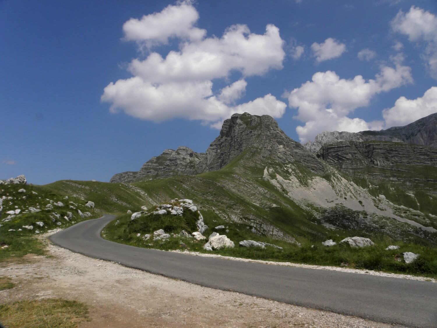
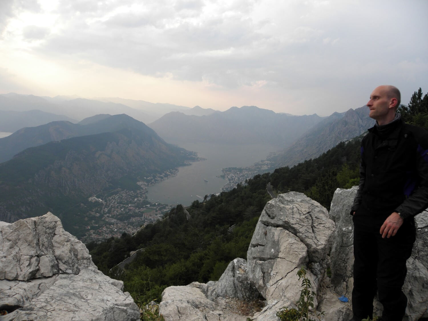 Just before Podgorica we stopped for dinner, very good anyway. A storm was gathering, the sun hid behind thick clouds, but it wasn’t raining and the stuffy atmosphere had become almost unbearable. Fortunately we quite swiftly managed to drive through the capital, which made very depressing impression. As soon as we could we moved away from it and turned towards Kotor. We got onto the most twisted way. First we were ascending among the rocks, covered with coniferous bushes, going higher and higher. Then we descended for a moment onto the plateau, from where we climbed again to admire from the top the spectacular views of the Bay of Kotor. Just a pity, that everything was hidden behind the mist (from the heat) and that the photos will not reflect that view. We stopped once more descending the pass, as we had the chance to admire the sunset over the bay. That view and experience will forever remain in our memories. The road to the Bay of Kotor has 25 serpentines and it is worth driving for the experience itself and for the stunning views which this route offers.
We reached the road no 2 to Budva hoping to quickly find the campsite, as it had just turned 8 o’clock. Unfortunately our hopes were in vain. The police closed the main road to the city. So we drove, or rather dragged on in a huge traffic jam, following a diversion through the mountains. We ended up in the centre of the crowded city. We wanted to stay there as the map indicated that there was a campsite. Due to the poor markings, heavy traffic, people walking onto the streets, the cars everywhere, total chaos and the fact that it was already dark, we did not manage to find a campsite unfortunately. So we drove on slowly following the main road out of the city. At one point Marcin stopped in the parking bay as he was tired, and there before us stood a sign: Camp 200m. Such a great was our joy, we quickly went there. The campsite itself left much to be desired. The showers meant 4 pipes sticking out of the wall at the back of the building with toilets, no curtain whatsoever, and the water was hardly flowing out. None of the toilets door was closing properly and every other bulb was missing. However, we did not complain much as we were too tired, not even the crowds at this campsite were bothering us. We fell asleep like children even though it was still very stuffy outside and cicadas were constantly making sounds.
MONTENEGRO:
– very mountainous country with main roads leading along the canyons and through dark tunnels
– roadside stalls with homemade cheese, honey, wine and fruit preserves
– look out for crazy drivers
– quite cheap inland
DAY 9. BORDERS, BORDERS…
Sveti Stefan, Montenegro –> Skopje, Macedonia (249 miles)
We left that unpleasant campsite as soon as possible. From the very morning the sun was already burning hot, and we still had few more miles of the coastal drive. The drive wasn’t going well as the traffic was heavy and it was so hot. On the way we stopped at a local bakery for breakfast, after which it was difficult to move on.
We got to the Albanian border and there we joined the queue. Well great, we thought, not known how much waiting in the scorching sun, there was no shade to hide in and the queue was moving at a snail’s pace. Additionally, the Albanian children were walking from one car to another, begging. It looked like it was going to be an unpleasant morning. Luckily, passing by young man said that motorbikes do not wait, that with motorbike you need to go to the front of the queue. First, we started off shyly, but soon the guards pointed us where we were to go. We got checked out on the crossing for pedestrians. They did not ask us about the Green Card. We thought there will be another border, so we moved on, and on and nothing there. And it stayed that way – we were driving without the Green Card.
 First impressions of Albania were very unpleasant, people begging on the border crossing, garbage all around. Overall feeling, that everyone was staring at us and honking. Marcin regretted that we drove into the Albania in the first place, and he wanted to run away from there as quickly as possible. As it that was not enough we took the wrong turn and unnecessarily drove in to the Shkodër city. And there – unbelievable chaos! Drivers driving as they pleased, omnipresent mopeds, bicycles, and everyone claimed to have a priority. One had to have eyes in the back of one’s head.
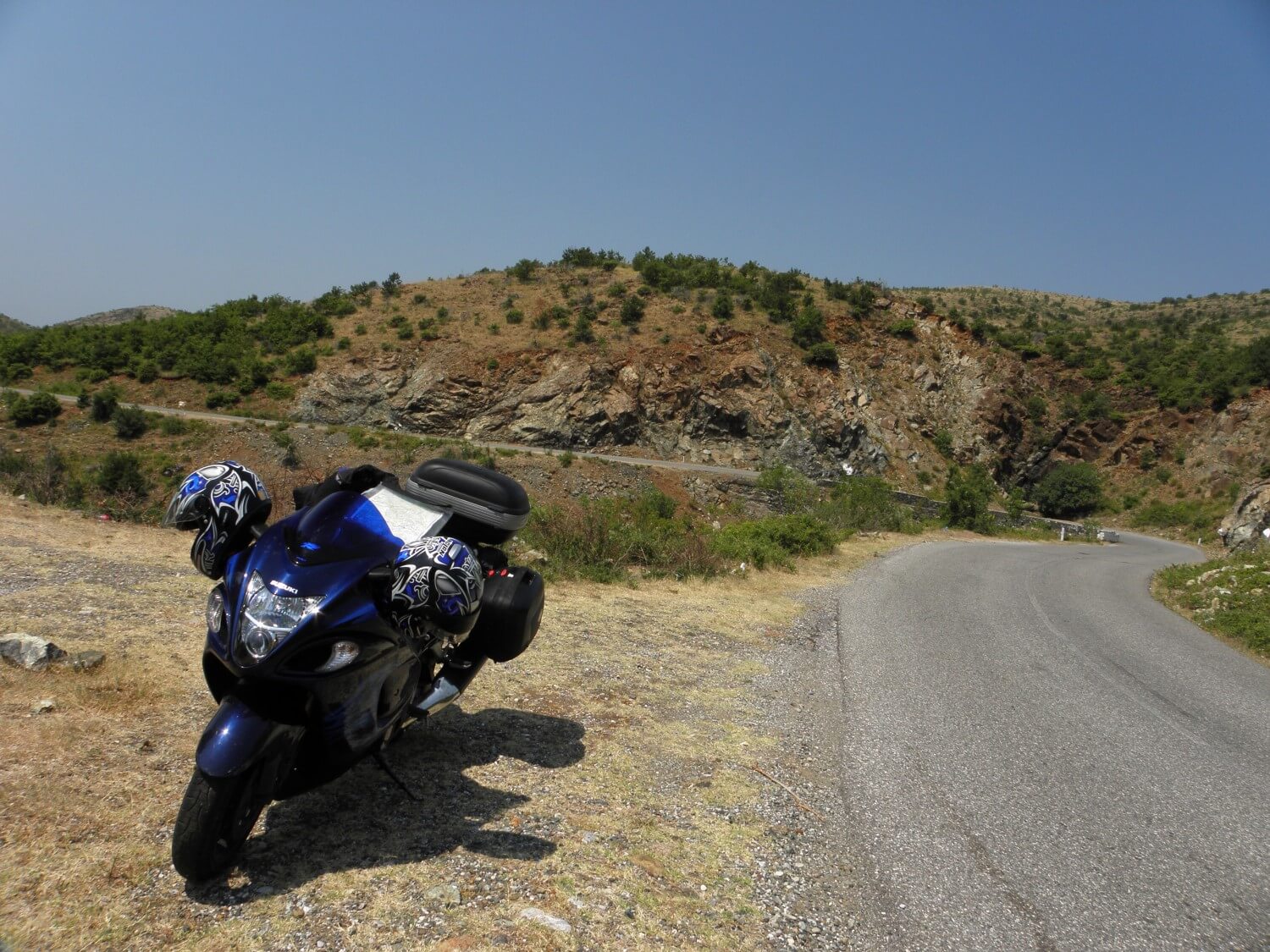
Fortunately we quickly found the right way and we headed for Puka. It got quieter on the road, but the road itself got worse. To start with, we were driving through some towns, where we could see the poverty, dirtiness and rubbish all around and other such unpleasant views. Soon, however, we left the cities and towns and we got to the mountains, or rather hills. The road ran on the slopes, where the sun scorched brown-orange ground was covered with low vegetation, bushes and stunted shrubs. There was nothing that could cast a patch of shade, and the sun burned mercilessly, as it was already about midday, so it was the worst time for a drive. Generally it was not going well.
The road meandered on the slopes, and although the distance to the border in a straight line was not so long, following those turns and bends it turned out to be more than 80 miles. The surface of the road was tarmac, patched, with holes, but we moved on ahead that was most important. At some point, however, we thought that we will get stuck there for ever. The surface deteriorated terribly, one pothole on another and unbelievable bumps, it was impossible to drive at all. We stopped helplessly, wondering if we were on the right road at all, and if it will go on like that we won’t be able to leave. We moved on slowly and much to our delight that gravel road turned into asphalt road again, poor quality, but at least it could be considered as road.
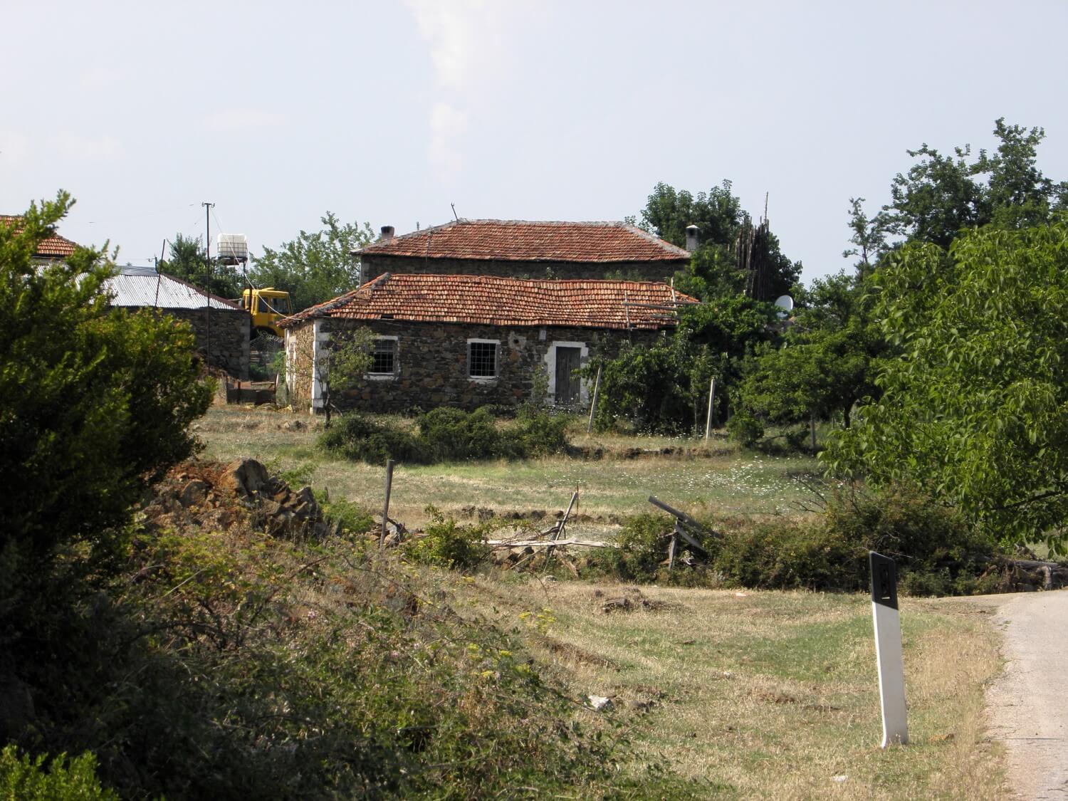 We passed through villages, where if not for the laundry hung to dry, we would have not though that anyone was actually living in those ruined buildings. However there weren’t many towns on our way. We drove on and on, the landscape was very monotonous, hills and hills only. Later on the surface improved a bit, so that our speed increased, but not by much as we had to watch out for stones and pebbles piled on the roadside and on the road, which made the driving more difficult. In spite of those inconveniences we managed to get to Kukës. There we got on to the express road, which took us to the border with Kosovo. The crossing went quite smoothly as we bought the insurance just before the check point, in the roadside booth.
We basically just drove through Kosovo without making any longer stops. To tell the truth, we wanted to stop for dinner, but when we stopped at a restaurant they said that they could only offer us some drinks, so we moved on. In Ferizaj we had a nice surprise. A nice motorcyclist, seeing us with an open map on the side of the road, stopped and asked if we needed any help. After having a brief chat we followed him, and he led us swiftly through a side road and onto the right track towards the border with Macedonia.
Along the way, we decided that since we did not have any luck in having dinner in Kosovo, so maybe we could at least stop there for the night. Until then we passed a lot of motels, but as soon as we decided to stay in the next motel on the way, we could not see any for the next few miles. And that is how we got to the border. After a short discussion we decided to cross the border anyway and stay for the night in Macedonia as somehow we felt safer there. It was already quite late, about 8 o’clock, and we had to wait first on the Kosovo border, then on the Macedonian border, where we also had to buy the Green Card (50€ for 15 days!). It was getting darker when we came across a sign of the campsite. Unfortunately we could not find it. So we drove on in the direction of Skopje. On the way we came across a hotel, where we booked ourselves in, in no time. As we had access to utilities, we sorted ourselves out, after more than weeks stay “in the wild”. In the evening we enjoyed ourselves with the air con turned on. Ahh… one quickly gets used to the comforts…
That day confirmed our bad luck on expeditions, which had set in on a tour round Western Europe, namely when we are looking for something, we cannot find it, and if we are not looking for it, it’s everywhere!
ALBANIA:
– it’s a country of contrasts; in large cities you can see modern, well-maintained buildings and hotels which are surrounded by piles of garbage; on the road you can see expensive car as well as old mopeds, which hardly were working
– poor quality roads, especially those local ones
KOSOVO:
– many unfinished buildings left on their own, from which other people made storage places for car tyres or hay
– in many places you can see the landfills of old cars
DAY 10. LAKELAND
Skopje, Macedonia –> Kastoria, Greece (278 miles)
We woke up very early, just before 6.00 am, probably because our bodies were confused after so many days of sleeping on the campsites. We ate breakfast at the hotel and we hit the road. At the beginning it went quite smoothly, because from Skopje to Gostivar we were driving the Mother Teresa Highway. We have to say that the Macedonian highway is an experience in itself. The surface is poor quality, in addition to standing on the roadside hitchhikers or people staring at the passing cars, an old man with the stick crossing the highway…what is going on there?
 Then we turned west and headed to Debar following the road no 409. We have entered the Nacionalen Park Mavrovo with a beautiful Mavrovsko Lake. The road meandered through a nice canyon along the river which led to the lake. The drive was very pleasant, as we were moving in the shade of trees.
Just on the outskirts of the city of Debar we stopped under the tree, with the intention of having short rest. Then suddenly a police car came up, and police officer wearing sunshades got out, and with him young policewomen. We were wondering if there are any problems, a road check or something else, when the policeman shyly, in broken English, asked if everything was okay and just explained that we stopped on their usual place from where they control the traffic on the road. The policeman played his part as best as he could and he gave us the directions. So we thanked him nice and moved on.
We drove along the Debarsko Ezero Lake, with dark turquoise waters, which is situated among the orange coloured hills, covered with lush green vegetation. A very pleasant drive. We drove through Struga and Ohrid and were following the road along yet another lake Ohridsko Ezero. The eastern shore of the lake looks like Riviera, many bathing places, hotels, B&Bs. The standards much lower than in Croatia, but there were many people anyway. The water in the lake was clear and warm.
Soon we entered the Nacionalen Park Galičica and began ascending serpentines to the height of 1568m. On the way it started to drizzle, out of the blue. We had not even had the time to be surprised when it started to rain heavily. This time we were lucky, because we came across a picnic site, where we stopped under shelter of roof, to wait the possible storm pass. It was raining quite heavily and even thundered few times, but fortunately it quickly passed and soon the sun returned. The Galicica Park is worth seeing. From there you can enjoy beautiful views of the Ohrid Lake from above, which looked more like a bay of the sea rather than a lake. There were beautiful views and beautiful mountains, just a pity that the road was not so beautiful. The descend road was a real torture. When we were descending we had a view of the Prespansko Ezero, where we soon arrived.
 As the road surface has slightly improved we moved on to Bitola and further down to the border with Greece. We got across without any problems and queues, as it was generally quiet on the border crossing. So we set out to conquer Greece. We stopped in Florina to eat something. We got solid portions of grilled meat, which I was able to eat only half and we paid only 19€ for 2 persons! One can dine like that :)
The next step was to look for campsite. Unfortunately we entered the agriculture area and our campsite search was in vain. So we drove and on. At the end of the day we found a wonderful stretch of road from Aminteo to Kastoria. The road was wide, smooth, winding, well-profiled, and tailored for motorcycle ride so to speak. It was pure joy. Just before Kastoria we spotted a hotel and decided that there no point in looking for campsite and we stayed there. We communicated with the gentelman using hands. He was already slightly tipsy and invited us to the party which was held at the hotel swimming pool. We politely thanked him and went to the air-conditioned room to sort ourselves out after another long day of driving.
MACEDONIA:
– flowery roadsides
– nightmarish roads, as we said that even Albanian roads are better than Macedonian. However we later found out that there were not that bad at all.
– beautiful parks and lakes, mountains to the west of the country, very few tourists – this country definitely has many tourist attractions
– many mosques, whose towers stand out from the landscape
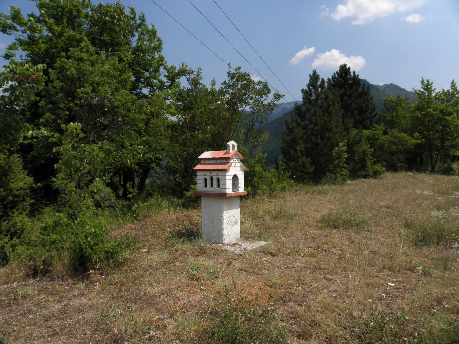
– small roadside shrines
– lots of wasps and large insects flying around your face
– slums on the outskirts of Struga and Bitola
– garbage on the roadside
GREECE:
– roads of much better quality
– we had to get our eyes accustomed to Greek letters. Admittedly the names of bigger towns on the main routes are written in both Greek and Latin, but of smaller towns on the side roads not necessarily
– general chaos, some kind of disorder and neglect
DAY 11. THE SWIMM DAY HAS COME
Kastoria, Greece –> Platamonas, Greece (320 miles)
We slept till 7.20 am, then swiftly packed up and went to breakfast by the swimming pool. The gentleman was serving us well as we were the only guests for breakfast at this time. We got delicious juice from fresh oranges; fresh and warm ham and cheese cob and warm chocolate croissant. It was very delicious and filling breakfast. The gentleman was so nice that he provided us with 2 litres of water for the trip as it was so hot, he said. We thanked him and moved on.
 First we got lost on the motorway, driving there and back looking for the right exit. As it later was confirmed, the Greeks are inconsistent and chaotic in exit roads marking conventions. Sometimes the junction is determined by the name of the first town by the junction (whether small or large), and sometimes by the name of a big city in that direction. For example, the signs lead to the motorway to Thessalonica, and just before the motorway there is junction, for Katerini to the left and for Volos to the right and no words where for Thessalonica. It was not clear how get directions, whether using names of big cities or rather small towns. It’s just a little digression.
In the end we found the right way and driving towards Ioannina through hilly areas of western Greece. The road initially meandered and sneaked, the surface was sometimes better, sometimes worse. So we had to be careful all the time, one could not drive at ease. What surprised us however, was minimal traffic on the highway as well as on the road we were driving (road no 20). So we drove on and on, we have not passed any major town, and then low fuel light came on. We were driving with the hope that in Konitsa we will refuel. And so luckily it happened. The heat was already merciless, but we raced off. On the way we stopped to buy a 4 kg watermelon, half of which we ate with relish stopping somewhere along the way. It was so delicious and so juicy… yummy…
The landscape was very monotonous, hills covered with sun-scorched grass vegetation and low shrubs and trees, which sometimes resembled the woods. Sun-scorched ground and omnipresent cicadas intensified the feeling of the heat. The air was incredibly heated.
Next we got on to the motorway, which was a sequence of tunnels and bridges. It was hard going on, as leaving the dark tunnel the eyes were exposed to strong light of the sun, but have not had time to adapt as the was another tunnel ahead.
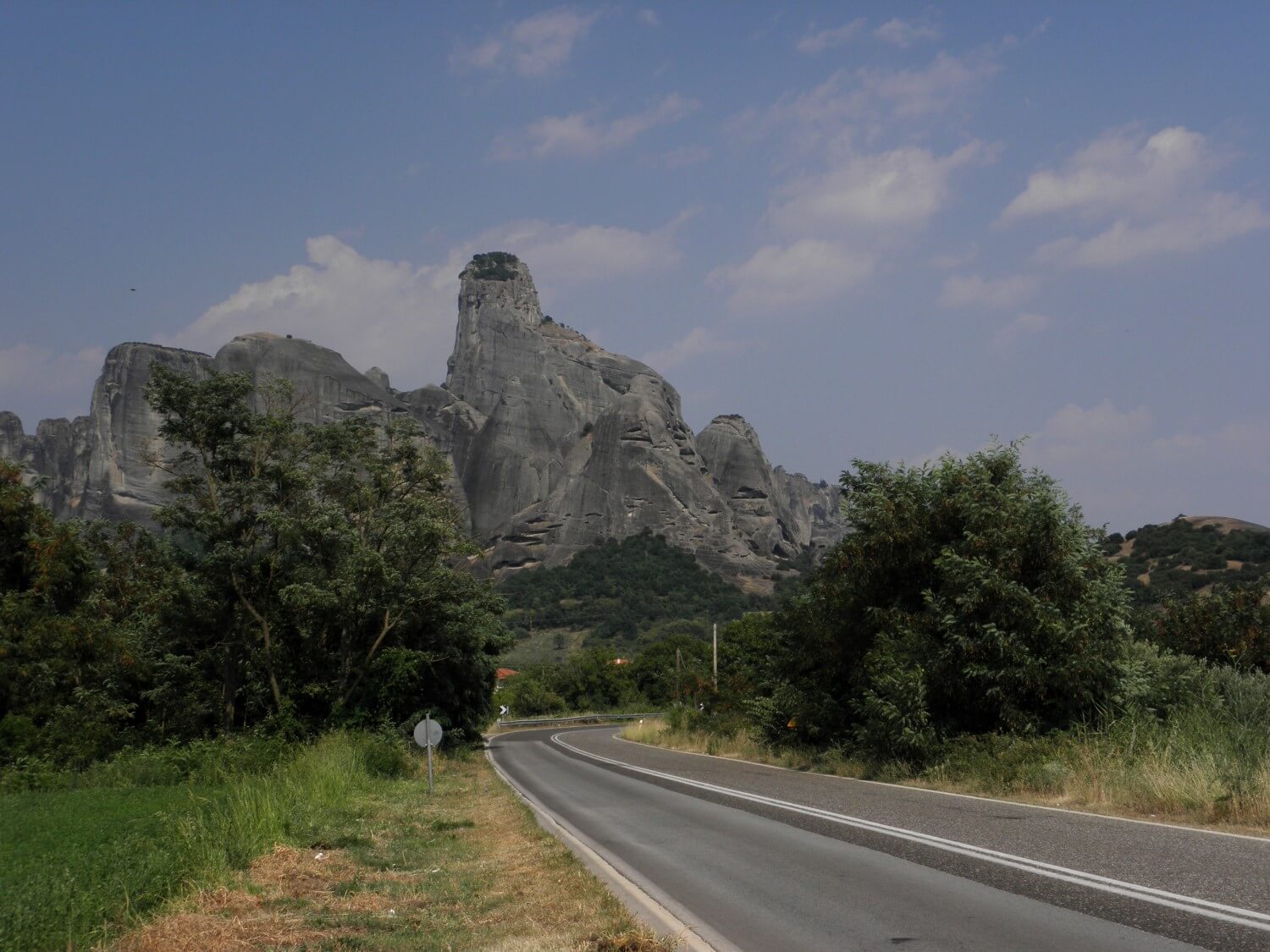 We turn onto the road towards Trikala, we were swishing happily, stopping only at by the roadside shrine to savour the second part of the watermelon. We reached Kalbaka and there we admired the Meteora Rocks. Superb views of the unique rock formations, which stand out on the background of Greek landscape. After taking few photos we continued our journey towards the coast. Once we got there, we drove into Platamonas, where in search of the campsite we had to break through the crowds of people in the city. First camping we came across turned out to be full. It was a good thing, because we drove a bit further and we found a quiet, little campsite run by a nice lady, where apart from us there was just one more tent and a few people in the huts. Above all there was peace there, which suited us better than the crowded campsite. As it was still early hour, we quickly set up the tent, put the swimming suites on and went to the nearby beach. It couldn’t be better. Not only the camping was quiet, but the beach also. There were very few people and friendly atmosphere. And finally we have swum in the warm waters of the “southern” sea. The water was clear, pleasantly refreshing, and simply wonderful! After the swim, and a short walk along the beach, we stopped at the tavern right on the beach, where we ate seafood as a light dinner. It was getting darker, but the atmosphere was great. This is how we relaxed in peace and quiet on the Greek coast. And who would have thought that in the place where we expected a crowd of tourists, it was so quiet and pleasant. And with this is nice touch we ended our day.
GREECE:
– small roadside shrines
– roads of mixed quality, but definitely better than the Macedonian
– inconsistency in the marking of the road directions
– overall negative impression, much of neglect, disorder, also litter on the roadsides, many wastelands and abandoned, not operating plants and factories
– road once build were left on their own, and because very few people use them, the road sides are overgrown with weeds; bushes and ivy are forcing their way on to the roads
DAY 12. DRIVING AT NIGHT
Platamonas, Greece –> Pavel Banya, Bulgaria (385 miles)
That was a stuffy night, I even got up to take the fly off the tent. In addition there was the noise coming from the street, and thus we did not sleep well. As if that was not enough, in the morning I discovered that we set the tent up right on the transit route of ants, and my side of the tent was quite black with these creatures. Therefore, I had a bit of morning exercise, but in the end I took only one ant with me on the journey:)
 In the morning we had a “getting there” part of the journey. We got on the motorway, first A1, and then A2 heading to Serres. We were following the route along the Lake Kerkini, and then straight to the border with Bulgaria and with some disappointment we left the neglected Greece. On the border crossing we had to wait in the queue for a while, good though we did not have to wait in line with lorries, as it would take a long time.
Bulgaria greeted us with increased traffic on the roads, which we were spared in Greece. First we drove the main route towards Sofia, which was quite tiring due to the heavy traffic. However, soon we left that route and turned towards the mountains. It got significantly cooler, the traffic was lesser, the road quite good, so it was pleasant to be driving. We could enjoy the rural life of Bulgarians working at the hay-making, which still were mostly done manually. Old women wearing headscarves and aprons, men in working shirts – such a typical old fashioned, idyllic picture.
On the way we had a light meal at a roadside bar. The eyes livened up a bit thanks to the lush greenery all around. We passed a lot of roadside stalls, where women were selling handmade products. We drove further the road leading through a canyon along the river. Apparently the route was marked as scenic, but the driving experience was terrible because of the holes and bumps on the road. Once we got onto the main route we decided to change a bit our initial plan of driving through Bulgaria and skip the part of it.
 It got quite late, after 18.00, but as we did not find the campsite where it supposed to be according to the map, we decided to take a chance and go further on. We got on the motorway, but first we covered a dozen additional miles of the access road. We left the highway one exit too far, but we decided to continue that way. It was already dusk when we were passing villages and small towns observing the life of Bulgarians, who as it turned out, like to sit in the evenings in front of the houses, sometimes on the sidewalks, watching the road traffic, playing cards or tending to their stalls with products for sale. Houses and villages looked poor and crumbling, but unlike the Albanian, they gave such a positive impression, they even looked friendly. The Albanian ones were quite depressing. At first glance Bulgarians seem to be friendly; they live poorly, but are satisfied with what they have.
In the meantime we left the towns and started to drive in the mountains area. It got quite dark and our speed dropped to sluggish pace, because of the extremely potholed and bumpy road, and the fact that the road was winding and one did not know what lurks at every turn, and whether some animals won’t come out on the road. Such focused we were moving slowly, but always forward. It also got cold. Crescent moon lit our way. All around us were dark bushes and woods, and fireflies creeping around. Finally we managed to arrive at the city of Pavel Banya, which turned out to be much bigger than we thought. Additionally, right on the outskirts we spotted the sign “pokoje/rooms/zimmer”. Unfortunately they did not have any vacancies, so we drove further into town. Somewhere I spotted a sign for the hotel, so we went in that direction, passing on the way many signs for private accommodation. We decided to try our luck in one of them. Trying to communicate using hands, it turned out that they did not have anything for that nigh. So we went to one of the hotels. Unfortunately they were full as well, but the nice gentleman, in English, nicely explained to us how to get to the Varna hotel. And there we went. We manged to get one of the last two rooms. So we quickly settled in and fell asleep instantly.
BULGARIA:
– the landscape livened up by woods and lush greenery of fields and meadows
– main road of good quality; side road of mixed quality, but one could see here and there road works being done
– old women in aprons and headscarves selling at the roadside stalls homemade products: preserved fruits, fruit juices, honey, mushrooms, etc.
– billboards along the roads, even those scenic ones, definitely spoiled the landscape
– horse drawn carts as means of transport of people and goods
DAY 13. ROCK FORMATIONS
Pavel Banya, Bulgaria –> Belogradchik, Bulgaria (277 miles)
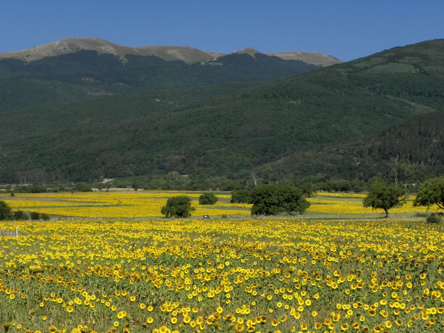 After a tasty breakfast and coffee at the hotel, we set off. It looked like it was going to be another hot day. To start with we had a hard time as we turned into a side road, which was very bumpy, so bumpy that as soon as it was possible we turned into a first road leading to the main road. We were heading towards the Shipka Pass. There the driving was nice as the road surface was smooth. We enjoyed a pleasant coolness which we could feel as we were moving up the mountain, and additionally there were woods around. We did not stop on the top of the Pass, but we moved on towards Veliko Tarnovo and further on in the direction of Sofia. It was more of a “getting there” part of the journey, as the landscape remained unchanged and we drove all the time to the west, on the vast plateau, with the mountains to our left and right. There were agricultural areas and many sunflower fields.
We arrived at Vartsa and there the bumpy terrain appeared. While the main intercity roads looked quite decent, in the cities they turned into a combination of potholes, ruts, cracks, bumps and everything else. The driving experience was terrible. The city itself added to this depressing image the view of dilapidated buildings, old and shabby factories. We run away from there as quickly as we could heading to Montano and further on to Belogradchik.
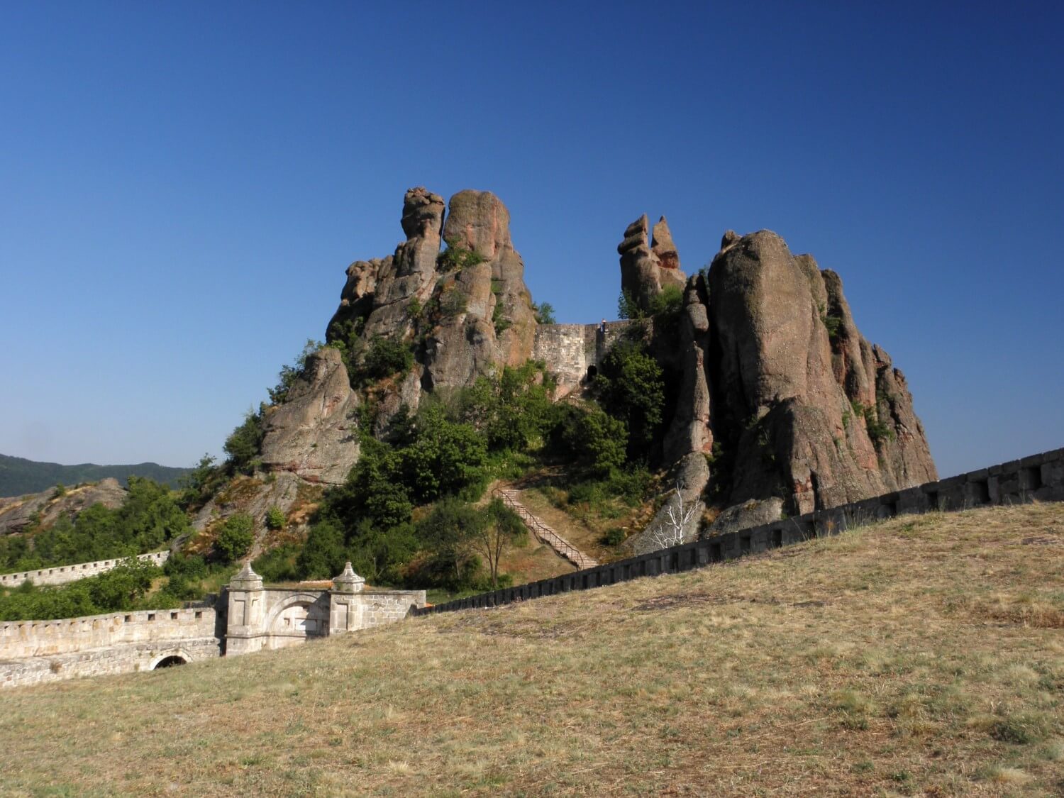 It just turned 5 o’clock when we arrived at the Kaleto Fortress, or groups of rocks. When we were nearing we already could admire some rock formations. We visited the fortress, or rather the ruins of an ancient fortress situated on the hill, from where we could enjoy views of the surrounding area of rock formations. It’s beautiful panoramic view. There are few walking trails around, but as they are quite long (8.7 miles and 5 miles) we did not attempt to walk them at so late hour.
Later in the city centre we were looking for something to eat, which turned out to be quite difficult. Finally in some side street we found a hostel/family hotel & restaurant, where we initially wanted just to eat something, but as during our drive through the city we did not see any signs of a campsite, we decided to stay for the night at that small hotel. Owners were really nice; they even offered us a garage to leave the motorbike in. We could not ask for more… well maybe just for the air conditioner in the room, which we were missing;) That day we had a little more time in the evening for leisurely sorting ourselves out, some relax and planning for the next day.
BULGARIA:
– abandoned, half-built and left to their fate, or closed buildings, which were, or were to be hotels and restaurants, created a quite distinctive atmosphere; little sad view that was, but on the other hand they are living cultural monuments, which once were supposed to be the symbol of a “splendour” of socialist countries and now they are symbol of political and economic transformations
– lot of sunflower fields
– the vignettes for motorcycle are not obligatory
– small villages are mainly inhabited by older people
– nationwide entertainment – sitting for hours in front of the houses and watching the passing vehicles
DAY 14. SHORT ADVENTURE IN SERBIA
Belogradchik, Bulgaria –> Bumbestii-Jiu, Romania (293 miles)
Unfortunately there was no breakfast in the morning, so set off right after we packed up. Still in town we refuelled and bought something to eat. We drove towards the border hoping that somehow we will get there, as it was supposed to be a small border crossing at the minor road.
The road was initially of good quality, but when we turned towards Salash then the bumps appeared. Just outside the town the road turned into gravel one, which was still under construction. We drove a bit further, and had to stop suddenly… the road came to an end – no pass, let alone a border crossing. As it turned out the crossing was just being build. That’s great, we thought, we won’t cross here. So we had to drive back some 6-9 miles, to the main junction, through the bumps again, obviously. It took quite some time, but finally we turned in the right direction to the border crossing in Vrška Cuka. As the road was not the best quality, these 25 miles took long time.
We arrived at the border, and there was another surprise. It was empty… deathly hush. And not only there were no cars in the queue as it usually is, but also there were no guards, only closed barrier. We waited a dozen or so minutes. Finally someone came out and without a proper look at the passports he let us go. Similarly was on the Serbian border- quick stamp and we entered Serbia.
 It began quite well, but after a few kilometres the road began to resemble a patchwork, with patch on the patch, bump on the bump. The speed and comfort of driving decreased dramatically. We had to mention, that we were driving the main national road, and not some minor one! Marcin swore at every meter of the road. Additional on our stops we were attacked by swarms of midges – we could not stand for a moment. Our moods has deteriorated, because we knew that in perspective we have had planned several dozen miles of driving such roads. However our plans changed, on the run so to speak. Marcin unaware that he was to turn into a road leading to the west, he continued to the north. I decided not to correct him. Therefore we were driving straight towards the border with Romania. To say we were driving is overstatement though; we were rather suffering to the very border. Even the Danube River did not look good from this side.
 We crossed the border in Đerdap near Kladovo without any problems. We moved on with relief to Orşova along the Danube, which from this side looked much nicer. The road was much better quality, so the driving experience was so much better. As we were already hungry we started to look for the restaurant and obviously, again we could not find any for a long time (such is our fate). But then when we found one, we got a small bonus in the form of a menu in the polish language:) The food was very good and very cheap as well. We also confirmed the rule, that where the lorry drivers eat there they have good food.
Romania, apart for the change in the landscape, brought us also some coolness in the form of rain. Several dozen miles from Petroşani it started to rain and we got a little wet. The road we turned into (no 66 towards Târgu Jiu) proved to be a one massive road work, with alternating traffic, lights, bumps and potholes. In short, the driving was terrible, even though the road led through a nice canyon along the river. We were hoping to find a campsite, as there were as many as 3 marked on the map, but they probably were not marked, as we did not find any of them. So we drove on. Fortunately the road surface has improved, so we could fully concentrate on searching for accommodation. We decided to stay for the night in a motel. It proved to be a good choice, because for the price of 70RON we got fancy room with superb bathroom. We sorted ourselves out and still had a moment for rest. “Busa” stayed on the side parking area, guarded by a bunch of dogs, so we could sleep in peace.
SERBIA:
– terrible roads, patches, potholes, cracks, bumps, and all that on the main national road (it’s scary to think what it would be like on the minor roads!)
ROMANIA:
– villages and small towns with typical settlements with low houses build one next to another, forming terraces
– traditional houses have facades decorated with ornaments and distinctive ornamented entrance gates
– people like to sit in front of the houses, chatting and watching the world go round
– the roads of much better quality, looking as newly built
– many picnic sites on the roadsides, but unfortunately they were terribly littered
– local drivers do nothing of the road regulations, overtaking where not allowed, not adjusting to speed limits, ignoring red lights at road works
DAY 15. TRANSALPINE AND TRANSFĂGĂRĂȘAN
Bumbestii-Jiu, Romania –> Corbeni, Romania (247 miles)
We woke up actually quite late, as we were not aware that there is yet one hour ahead on the clock. Therefore, we left our motel just before 9. „Busu” was covered with thick layer of dust that came from road works nearby.
 From the morning we were following the main road. We wanted to have breakfast before we enter the mountains. We spend some time looking, as they have many coffee-bars, where they serve drinks only. Finally, one of the waitresses in the bar advised us where we had to go. We ate delicious omelettes and with full stomachs (“Busu” also got breakfast ;) we were ready to climb. We started to ascend the Transalpine Route. Although, form the distance you could not see the height we were to climb, we were moving up and up, swishing on a surprisingly good road. It got pleasantly cooler and the ride was great. At the viewpoints, there were many stalls with gifts and homemade products.
On the second section of Transalpine 67C condition of road surface has deteriorated slightly, there were patches and gravel sections. Somewhere on the way we stopped to lubricate the chain. We also gave into temptation and bought some raspberries from roadside seller, but we quickly regret that, because they were wormy and so they ended up back in the woods. We made up for it a moment later, stopping at a restaurant for coffee, pancakes and ice-creams. It turned out that we have chosen the right moment, because it started thundering and then raining. As soon as the heavies rain has passed by we moved on and soon we left the clouds behind.
The road was nice, but quite bumpy. Instead of going to Sebeş, we turned to Jina, where we got driving a smooth and winding road, which surprised us positively. Jina is quite nice little town, where at that time a folk festival was taking place. Just before Poiana Sibiului a couple on motorbike overtook us. Further down the road, they waited for us, so we stopped next to them and chatted for a little bit. They inquired the locals earlier, and advised us to go straight to Miercurea, as that road was supposed to be of better quality than the one we planned to go. We listened to this valuable advice and went after them. It quickly turned out that we did well, because soon we were on the main road leading to Făgăraş. Just before the junction with 7C we refuelled and ate a little something.
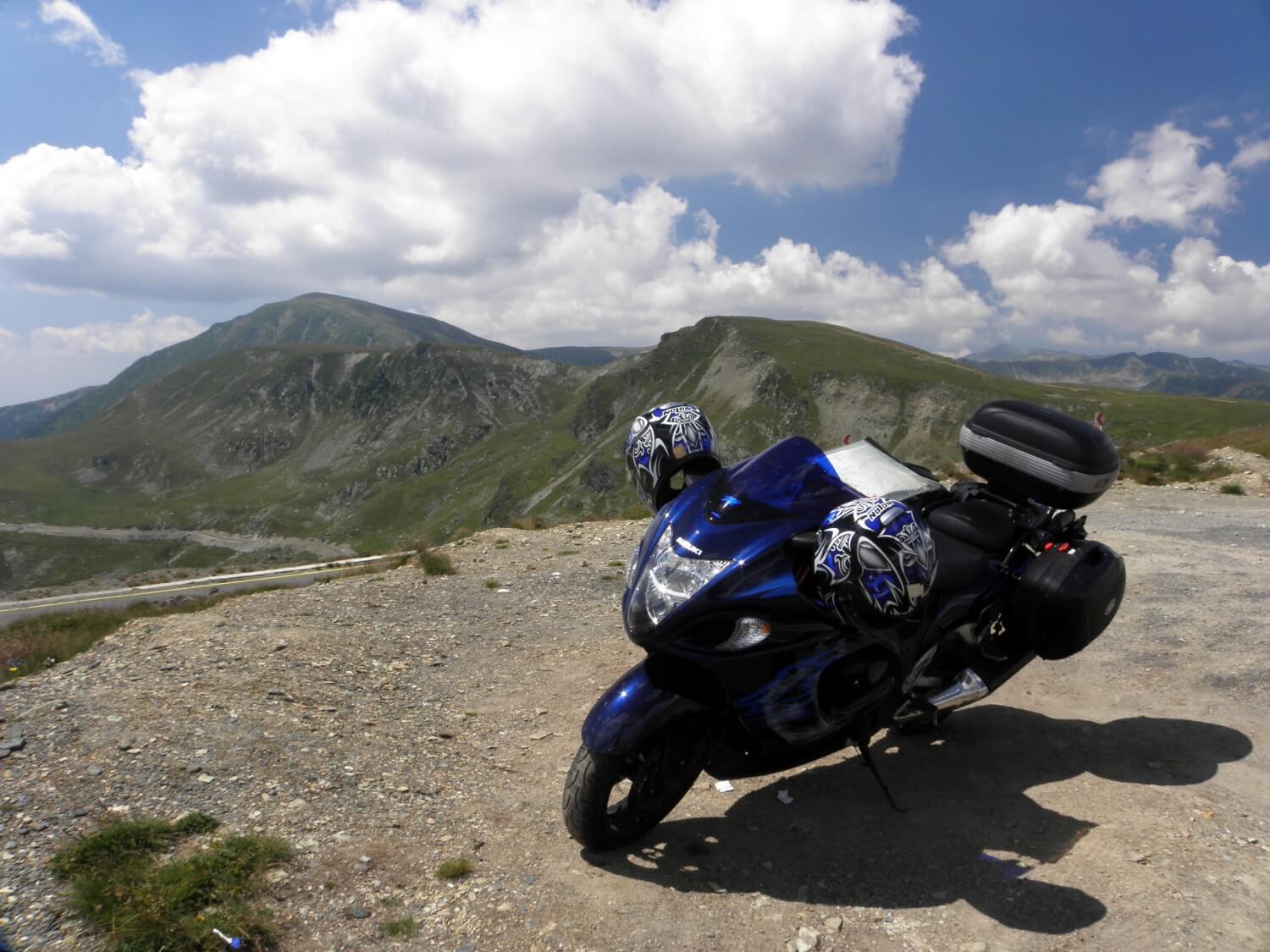
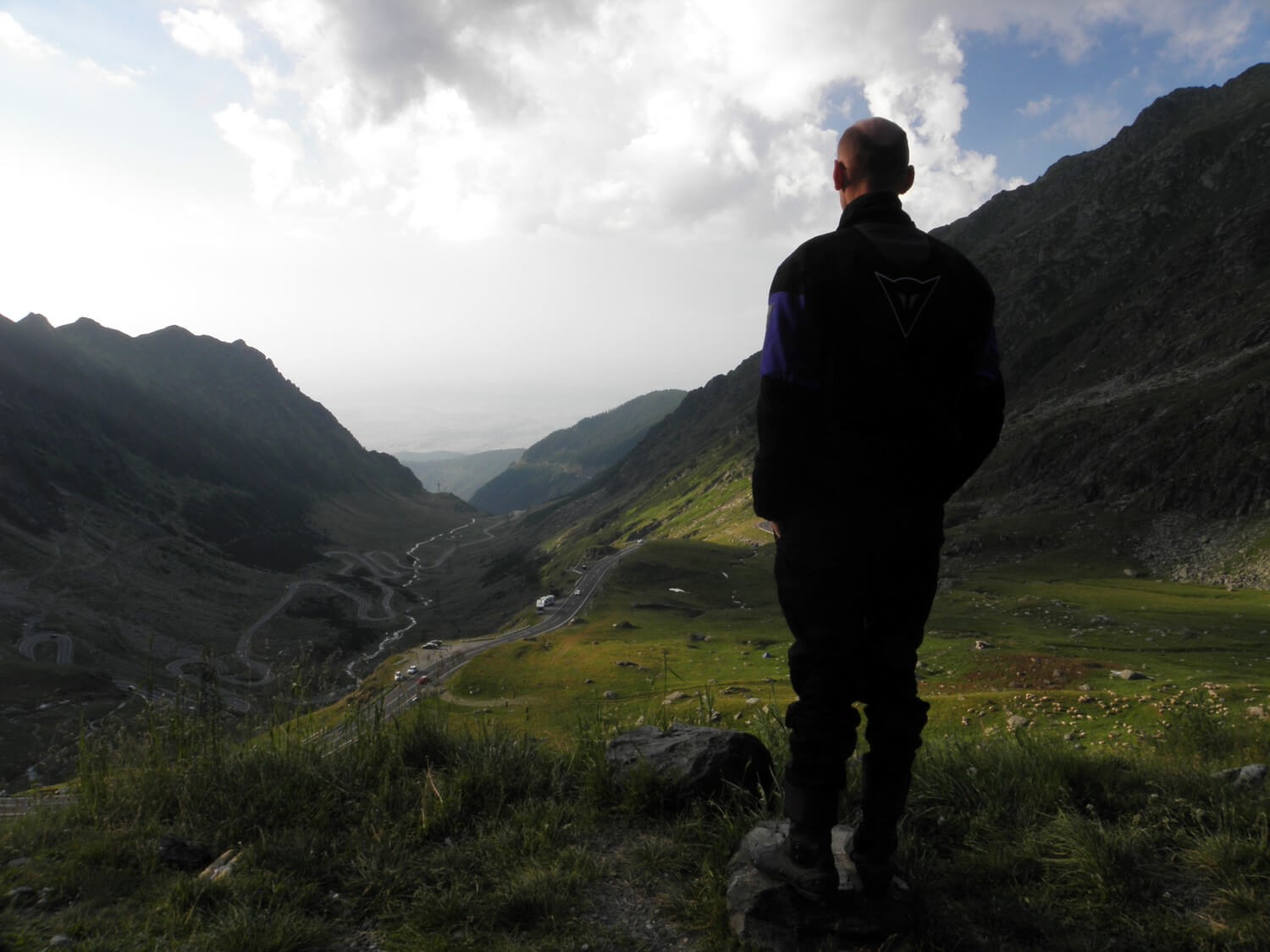 It was already 6 pm when we entered the Transfagarasan route. To tell the truth I was expecting much better surface. Unfortunately it was quite bad, so the driving experience wasn’t good, even though the route itself is magnificent. The road winds its way and meanders towards the pass revealing more and more of the beautiful views of the mountains and the route itself. We stopped several time on the side of the road to take photos. The traffic was heavy and of course there were many motorcyclists as well. It got noticeably chilly. Just before the pass we entered the tunnel, and one moment later we were on the other side of the Fagaras Mountains. Great views from the top, the road tossed on the slope. It’s really worth to drive this route; you only need to prepare yourself for a proper shaking on the bumpy road.
We thought that the descent from the pass will take less time, but it turned out quite differently. The road ran along the shore of the lake and wound its way surrounding the bays, for several dozen miles. We had the impression that we were circling the lake several times, as it took so long. Additionally it got quite late, and the road was very bumpy, so that last section turned out to be very tiring.
Finally we got to Corbeni and there we settled in the Arizona Guesthouse, where we had a pleasant evening with a dinner and talk about our further journey.
ROMANIA:
– it has its own charm and many tourist attractions, that’s for sure, but it will probably take some time till the „west” will began to coming here. Overall, the country has much to offer, although it still needs little more investment in tourism, especially in road infrastructure
– camping network not big enough as for us, we still not came across campsite that would met the western standards. True is, there were picnic/camping sites in the mountains, but there were crowded with almost no facilities
– network of guesthouses, motels, small hotels if fairly well developed, especially in the mountainous areas
– it’s still cheap (from our point of view, of course), 2-person room for the price of 70RON is common, and this is just 8€. In Western Europe for the cheapest camping we paid more than that!
– the roads of different quality, in sections on one route, it was difficult to tell if the main road will be actually good
DAY 16. TRANSYLVANIA
Corbeni, Romania –> Gilău, Romania (288 miles)
We were awakened by the sun peeping in through the windows. We got up quite early and we set off right away without any breakfast. Unfortunately, we had to get to the main road, and that meant driving the “yellow” road, in other words the minor one. Initially it was not so bad, but with every mile it was getting worse. Eventually it became a way of concrete slab plastered with asphalt here and there. It was impossible to drive. Every mile was a torture, and we still had about 20 to go! Additionally, traffic was quite heavy, which surprised us, as it was Sunday after all. The cities were full of people, perhaps it was a market day or a national holiday, it was hard to tell. With great difficulties we got to Câmpalung, where in the supermarket we bought sweet rolls and yoghurts, which we ate on site.
Next we headed for Braşov. The road meandered through the valleys and on the hill sides, revealing beautiful views of Trasylvania. It’s worth to visit this land. However, for us the pleasure was only for our eyes, because the traffic was quite heavy and the way Romanian drive it all took away all the driving pleasure. You had to be careful at every turn. Drivers overtake carelessly, push their way, force others to hard braking, drive straight at the oncoming cars. In addition, they do nothing of the speed limits. It took away some comfort of driving as we did not feel safe.
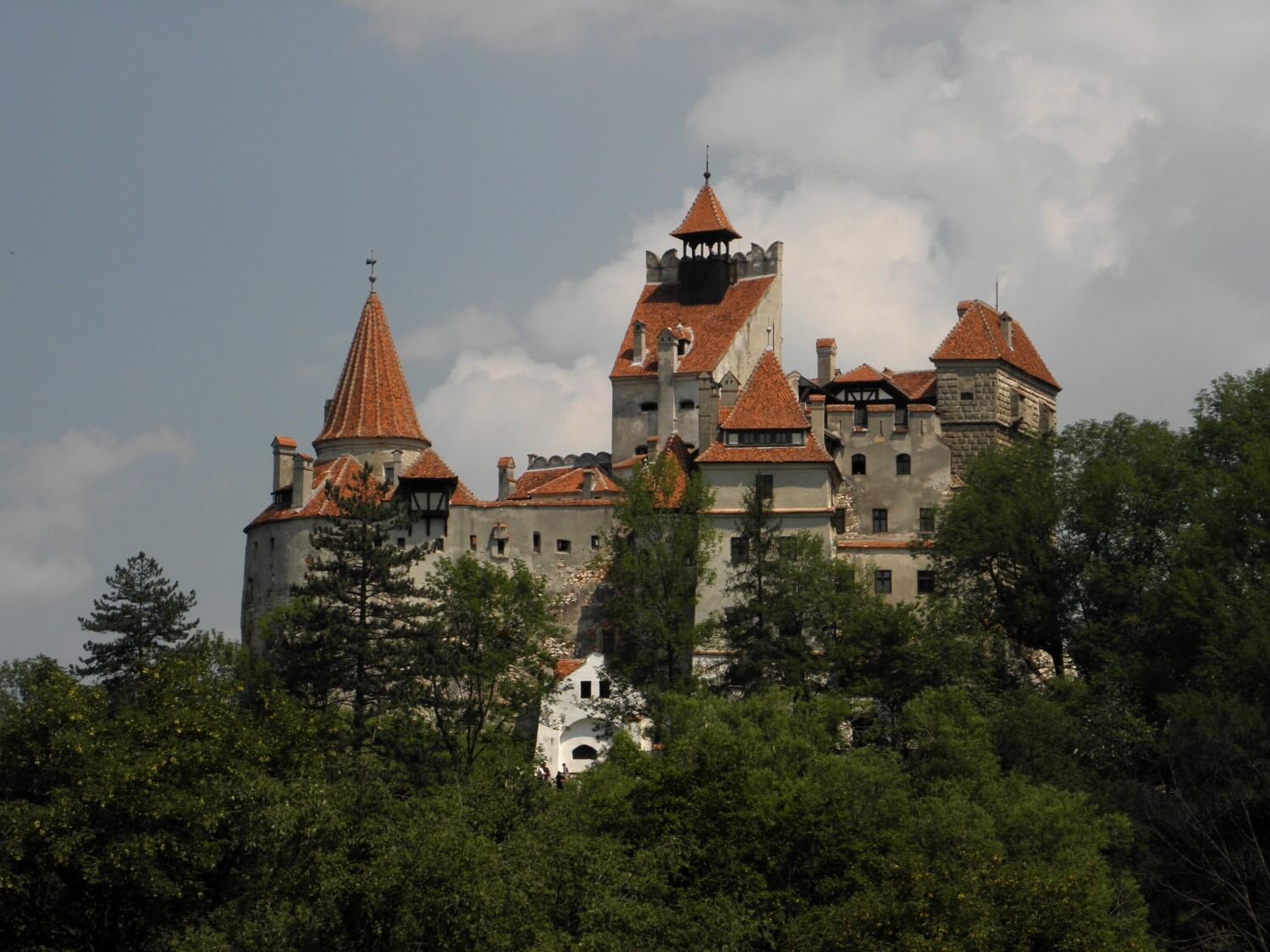 Just before Bran (with the alleged castle of Count Dracula) the traffic got so heavy that we moved with speed of 5 miles per hour. It took quite some time to cross this stretch and it tired us as well. Overall, the drive was going bad that day. Miles stretched into infinity, our bottoms were unusually sore. We both struggled physically as well as mentally.
Just before Târgu Mureş we stopped for lunch, during which we rested a bit. We wanted some dessert, we chose the cheese dumplings. We had to wait a bit for them, but it was worth it. Their taste and size exceeded our expectations. Unfortunately, they were so delicious that we couldn’t resist eating them all. Therefore with aching tummies we loaded ourselves on the bike and slowly moved away. All around the storm clouds were gathering, it was thundering and lightening in the distance, but somehow we managed to avoid the rain clouds.
At the earliest possibility we pulled onto the open section of the highway and sped away. Unfortunately this time we were not spared the rain. It besprinkled us a little and cooled us down, but at least the drive was more pleasant. We swished through this short stretch of motorway, refuelled and started to look around for a motel. And then suddenly, unexpectedly we came across a sign for the campsite! Imagine our surprise. We went there and decided to stay. After so many nights in motels we almost forgot how to set up the tent. Unfortunately the campsite was right by the road, and it was the main one, so the traffic did not stop all night. In the evening we did not notice it, because we were so tired and we fell asleep like children.
ROMANIA:
– the farther to the west the more expensive
– well-marked roads
DAY 17. IN HUNGARY
Gilău, Romania –> Putnok, Hungary (344 miles)
For the first time in two weeks we slept in sleeping bags, i.e. it was so cold that we had to wrap up in sleeping bags. Additionally we woke up in a wet tent. You could definitely feel the change of climate. In the morning I got cold when I was writing my notes, because it was so cold.
We packed up the wet tent and headed for the border with Hungary. We still had about 90 miles of driving with Romanian drivers, which did not fill us with optimism. Fortunately, it was going quite good, it just was a bit chilly. We spend last RONs on breakfast somewhere on the way and then we headed to the border, which we crossed without problems.
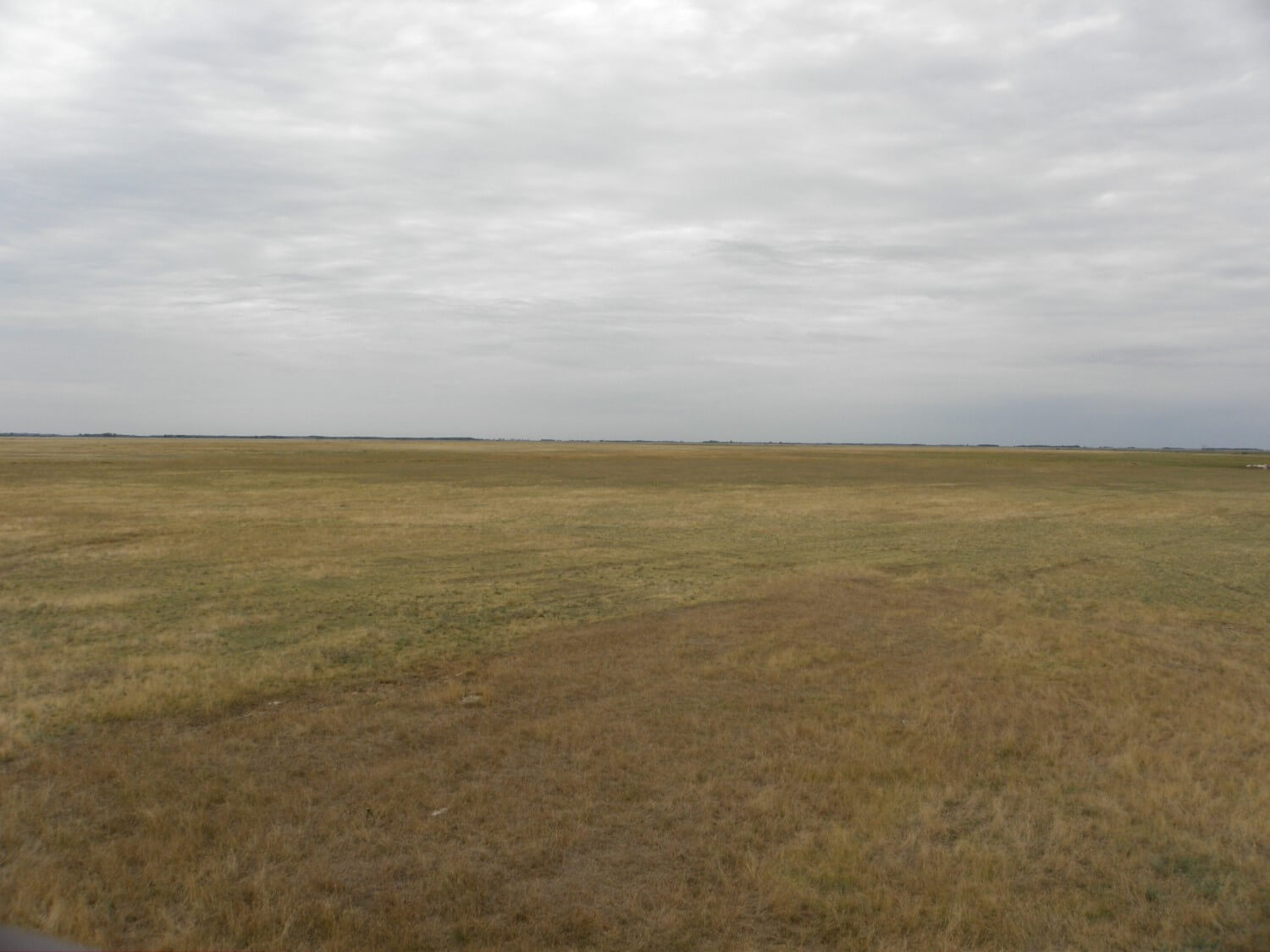 From the very border you could feel the change of climate and culture. Quite different driver’s mentality, good roads and well-maintained roadsides. The drive was more pleasant. To start with we were moving in the dark, as we did not have a map. We got to Debrecen, where we bought the map, refuelled and then left the city. After short time we stopped at a roadside restaurant. The intention was only for coffee, but we had a good soup, then even better pancakes and coffee with it. In the meantime we also planned our further journey, as for Hungary I did not have the route drafted on the map. So I just marked the interesting places and we decided which roads we will go.
For a start we were to drive through Hortobágyi Nemzeti Park, which we really liked, though there is not really much to see there. We stopped at the lookout tower and from the top we were admiring that amazingly flat steppe land to the distant horizon. The sky was overcast, the wind howled and whistled through this wilderness, which added more impressions and created an amazing atmosphere. All around such peace, you could switch off completely.
We got to Füzesabony, and from there as it was going well, we headed slightly to the west to drive through the Mátrai mountain range. But before we arrived there, it started to rain. We saw the rain clouds from a distance, but we took the risk and after a short time we were driving in the rain. Fortunately it was not raining heavily and soon the rain eased and when we started driving in the mountains it stopped raining completely. Only the road was wet and therefore less comfortable to drive. We drove through beautiful hills covered with beech trees, where every few kilometres there was a hotel and quite few people around.
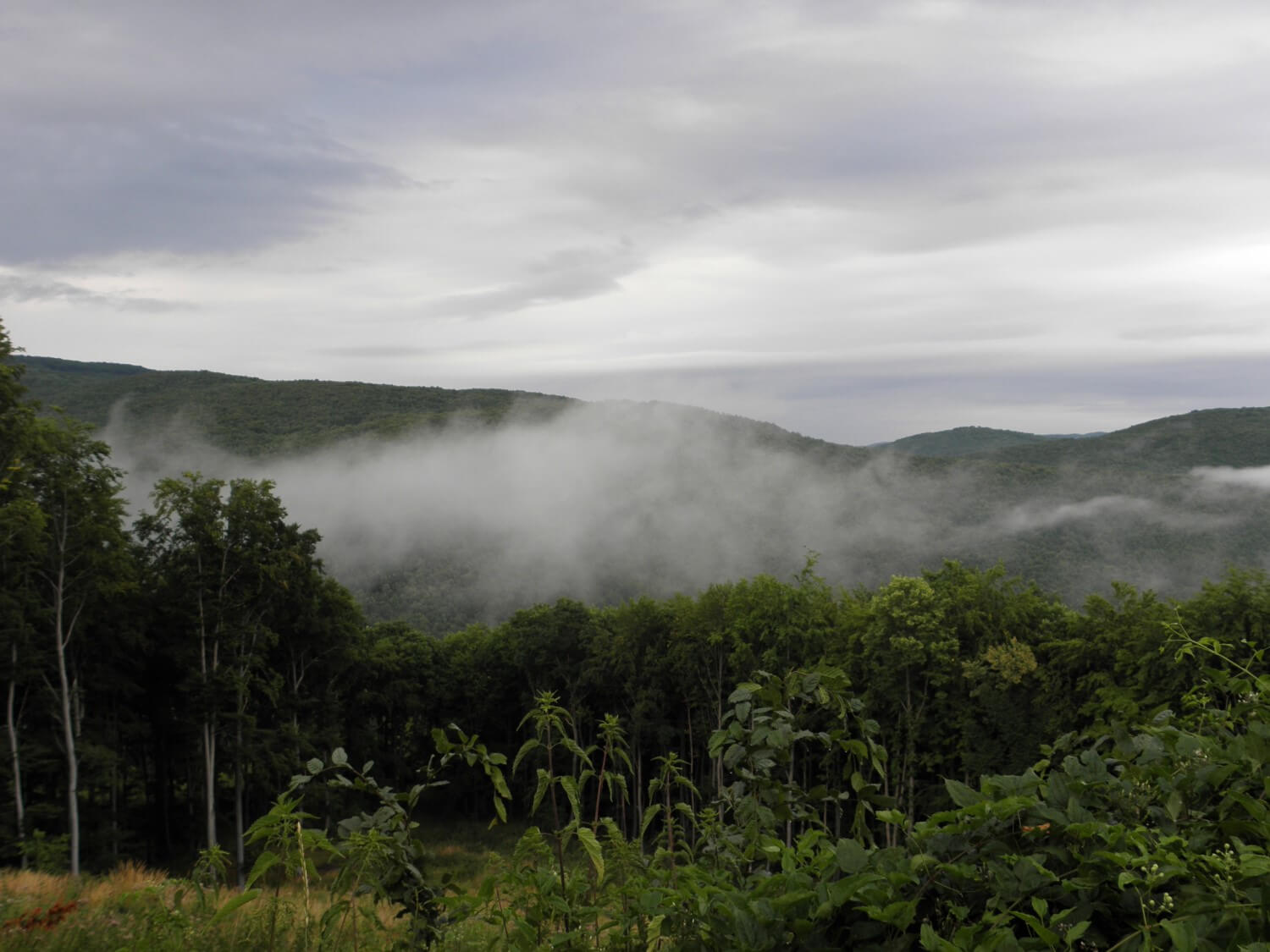 Quite smoothly we arrived at Eger, from where after refuelling, even though it was after 18.00 already, we moved on through Bükki Nemzeti Park. The road led through beautiful, dense beech forest. It was going well, the surface, though wet, was of good quality and traffic virtually non-existent. We were moving quite smoothly until we turned into a side road, to avoid the Miskolc town. The road become narrow and got a little worse. Our driving speed dropped as well. It got much colder as we climbed a little bit up and it was quite late as well.
The area was very beautiful and picturesque, just a pity that it was getting darker. With every mile the road surface was deteriorating, but we kept on moving. In the villages we were passing through, we were searching for campsites, but neither those nor the motels were to be found. Finally we reached the main road no 26 and we headed to Putnok hoping to find something there. Circling around town we spotted a sing for camping, but unfortunately we did not find the campsite itself. We only came across a bunch of dogs, and quickly escaped from there. In the end we found a sign for “accommodation”. We went there as quickly as we could. The gentleman did not speak English or German, so the conversation was in monosyllables, using hands. To start with, he said that he didn’t have anything, but probably seeing our resigned faces (if in the dark you can actually see anything), he started to explain something pointing at the rooms. It turned out that one was under renovation and the other was just not cleaned after the previous night. We said that it did not bother us, it was ok. Finally the gentleman agreed, but told us to wait outside while he will be cleaning the room. He even changed the bed sheets. For us, it was much more than we needed, we even had a hot shower. Although the bed was hard and a bit broken, we fall asleep fast.
HUNGARY:
– better driving etiquette, the roads well marked, you could see a higher standard of living, at least in these villages which we passed through
DAY 18. ICE CAVE/ BRYNDZOVÉ HALUŠKY
Putnok, Hungary –> Mošovce, Slovakia (236 miles)
We got up quite early. On the outside you could feel the morning coolness, that’s another such a day. In the morning we wanted to get to the border with Slovakia passing through Aggteleki Nemzeti Park. Shortly after leaving Putnok we drove into the fog and throughout the entire park, up the border, it was cold, gloomily, dark and foggy. In such a mystery atmosphere we were driving nicely, as the road was of unusually good quality. In search of food we entered a village, but we quickly ran away from there, because we felt like intruders in a zombie town. There were many people on the streets, in front of the houses, and everyone with dispassionate gaze was following us. As we didn’t find any shop there, with great relief we moved on.
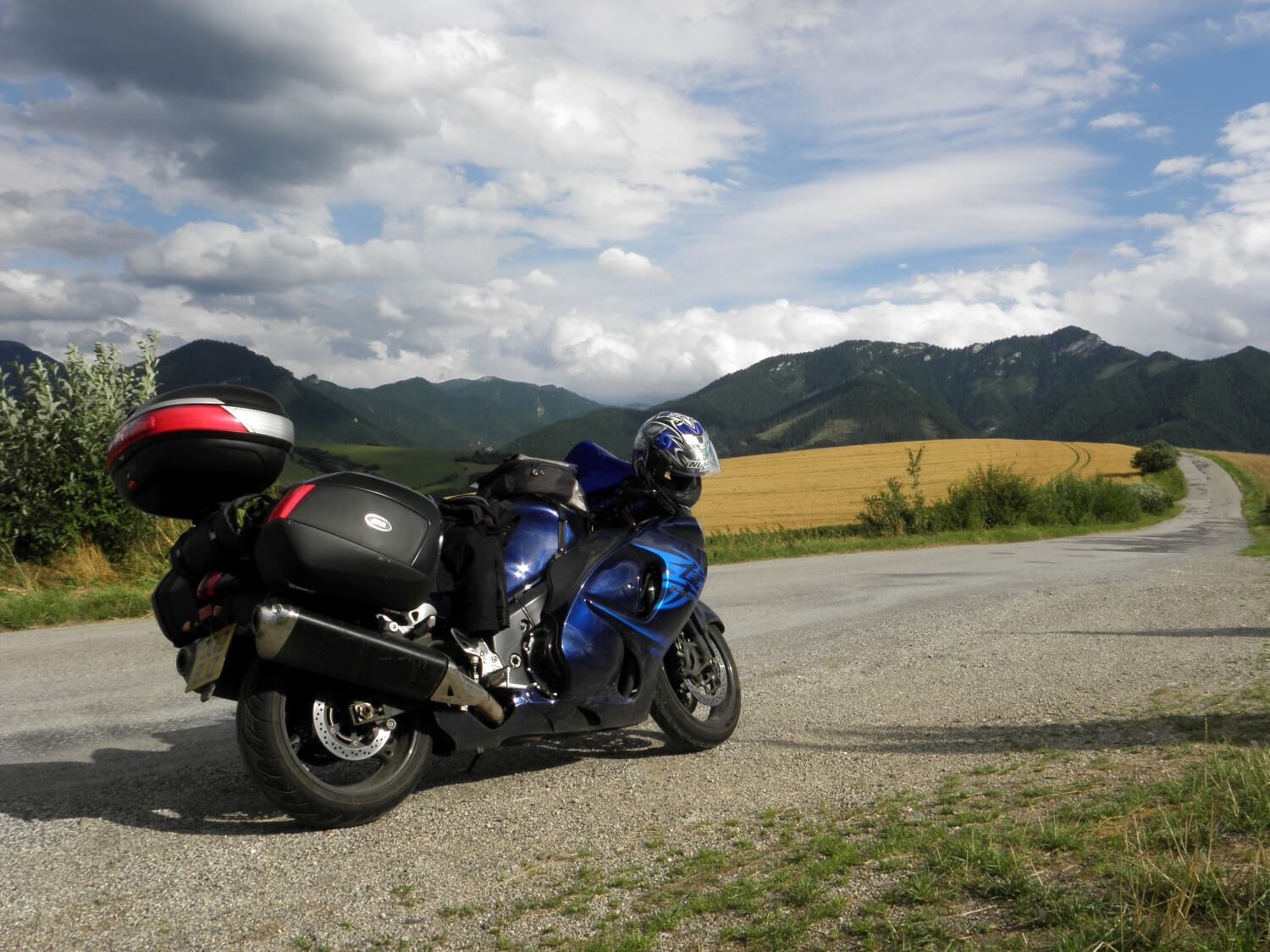 Shortly after crossing the border we stopped for breakfast, a delicious omelette with locally made sausage. In the meantime, the sun dispelled the fog and it got quite nice. After breakfast, at the car park we did quick chain lubrication and headed in the direction of Narodný park Slovenský raj to see one of local caves: Dobšinská ľadová jaskyňa. But before we went there we pleased ourselves with delicious coffee and strudel with cherries.
To reach the cave you have to walk for about 25 minutes, up the hill all the time. Just as we arrived, we joined a group with an English automatic guide. The cave is worth a visit, but for me the groups of tourists were too big, which did not allow seeing the cave fully, because one was more focused on walking in line from one point to another. But at least it was a nice break from constant driving. We were joking that such an ice cave could be of use for example in Croatia, to cool off.
Anyway, we moved on further driving through Národný park Nizke Tatry. The general condition of the roads was satisfactory so far, and apart from few worse fragments we could swish through the charming Tatra valleys. At the top of the Čertovica Pass we stopped for a meal. We decided to try the local speciality, which are Bryndzové halušky. As for us it was too much of halušky and too little of bacon. I like it anyway, but Marcin won’t decide for another serving any time soon.
 According to our “schedule” we still had one more attraction to see, namely Vlkolínec settlement, which is a living open-air museum. Hidden somewhere in the mountains a small village, settlement with charming little houses that beautifully presented themselves on a background of the mountains covered with dark forests. We walked along the main street and because it was 18.00 already we moved on looking for accommodation. From the road no. 59 we turned into road no. 14, which took us to the other side of the Veľká Fatra mountain range. There, with the help of local people we managed to arrive at the campsite, or rather recreation centre, where we settled in a small hut and got some rest in the evening.
SLOVAKIA:
– well marked roads, a lot of restaurants, hotels, guesthouses, near and in the national parks
DAY 19. CZECH REPUBLIC
Mošovce, Slovakia –> Bystřice nad Pernštejnem, Czech Republic (222 miles)
Good thing we stayed for the night in a hut and not in a tent, because it started to rain heavily at night. At about 5.30am when I woke up it was still raining and same at 8.00am, the sky was overcast. If we would sleep in a tent it would be very difficult to pack up and leave.
We decided to eat breakfast at a campsite eatery, hoping that in the meantime it will stop raining. Our hopes were in vain. In addition, there was a power outage and we ate our breakfast in the semidarkness. Anyway, we put the jackets on and got on the road. To start with we had a difficult section of the journey, as the road no. 65 to Martin it was one big joke: concrete slabs, with potholes and patched here and there with asphalt. Oh, the drive wasn’t going well, and in the rain and the morning cold.
 Further, we headed towards Trenčin, to the border with Czech Republic. It looked like we were going in the right direction, because the sky was clearing up and it was no longer raining, only drizzling. Drive through the cities tired us as usual, but the most important thing we were moving slowly towards Czech Republic. Along the way we helped ourselves out with hot coffee, they didn’t have any cakes, but at least the coffee was good. We put extra layers of clothes on and started to cross the border. It stopped raining altogether, but it was still cold. We got onto an interesting route, road no. 495 to Zlin, which was going once uphill then downhill, like on a roller coaster. The sun was shining; around us fields with ripe grain were unfolding, creating landscapes pleasant for the eyes. The road surface was of good quality and the driving was comfortable.
Soon after, we stopped for lunch and planning our journey through Czech Republic, as we have just purchased a map and we had to sort it out somehow. Next section of the journey turned out to be quite boring and a bit tiring as we were passing through concentration of cities and roads. Somehow we managed to get on to the right way and we entered the Moravský kras nature reserve. Unfortunately we did not visit any of the caves, which there are plenty in this very area.
We turned into the road no. 19, which lead in a westerly direction through beautiful wooded and hilly areas. We started looking around for a campsite. We managed to find one in the woods by the lake, which was primarily intended for fishers, there were many of them, but it did not bother us at all. We decided to settle in a hut, which turned out to be right decision, because soon it started to rain, and a moment later it was pouring down.
CZECH REPUBLIC:
– well marked and good quality roads
– network of campsites is quite good, but they are usually concentrated in popular tourist areas
DAY 20. PRACHOVSKÉ SKÁLY
Bystřice nad Pernštejnem, Czech Republic –> Kyselka, Czech Republic (262 miles)
We woke up quite late, after a very cold night. The sun was shining, but the air was chilly. Then and there we put additional layers of clothes on. We left in the morning without breakfast, everyone around were still asleep. Heading towards Jičin we were looking for a chance for breakfast. We drove many miles before we found something suitable for that time of the day, but at least the breakfast was good and filling.
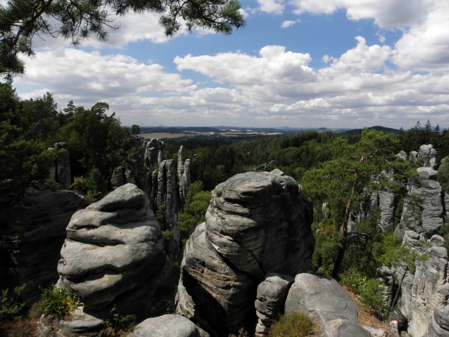 Just outside of Jičin we turned towards the national park Český ráj, where we went on a tour of Prachovské skály, or the Czech rock formations. Definitely worth a visit, but you have to prepare yourself for a minimum of half-day walk. We chose a minimal option and we did the smallest “circular” walk approx. 1.9 miles long. We liked it very much. Rock formations, through which we had to squeeze past sometimes, make a striking impression. We got hot a little, because as usual we were in our motorcycle clothes and everyone around in shorts and sandals. We enjoyed our time there, and at the end of the walk we pleased ourselves with coffee and pancakes with jam.
Next, we returned to the main road, to gradually move towards the border with Germany. In fact the next part of the day it was just a ride with a break for lunch at a roadside restaurant. But it was a pleasure to drive. Good quality road meandered between fields, ascending the hills, descending to the valleys, led through forests, villages, cities and towns. Additionally it was so clean all around. One has to admit that the Czech landscape is pleasing for the eye. The farther to the west, the more of isolated hills appeared on the horizon, often with a castle or ruins of ancient fortresses.
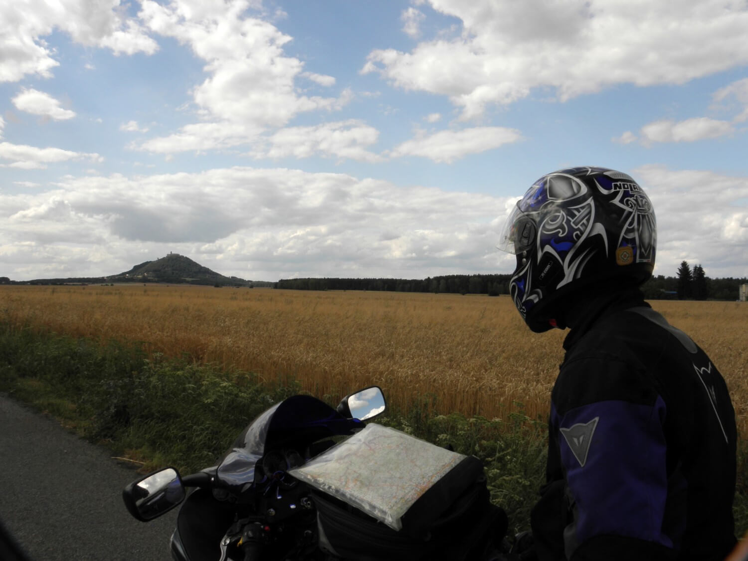 The whole day was quite cold and quite windy, but at least it was not raining. At the end of the day we had a little trouble finding the campsite. We turned into a narrow lane, and not entirely convinced that we will find something, we were following quite nice road along the river. Fortunately we succeeded, and after a short discussion where to set up our tent (there were many people), we returned again to our own, unfortunately wet, little house. Before going to sleep we went to the local restaurant and drank some tea to warm up before the night, which was going to be cold
CZECH REPUBLIC:
– terrible method of marking, or rather the lack of marking the road diversions. Before the point of road closure, the names of places and directions on signs are crossed out, and that’s all, no arrows where to drive instead, simply you’re on your own. We had several such situations; we trusted our intuition when searching for any signs that will lead us on the right track
DAY 21. ON THE RHINE RIVER
Kyselka, Czech Republic –> Boppard, Germany (336 miles)
The night was quite cold and the morning also. Marcin rested in a tent long enough that the rising sun began to dry our tent before we started to pack up. We decided not to stay for breakfast at the restaurant, but at once we moved towards the border. It was going quite smoothly. Just before the border we stopped at the petrol station and there we ate breakfast, which consisted of yesterday’s bread roll, but at least we had warm drinks. We refuelled to use the last of the Czech crowns and we crossed the border.
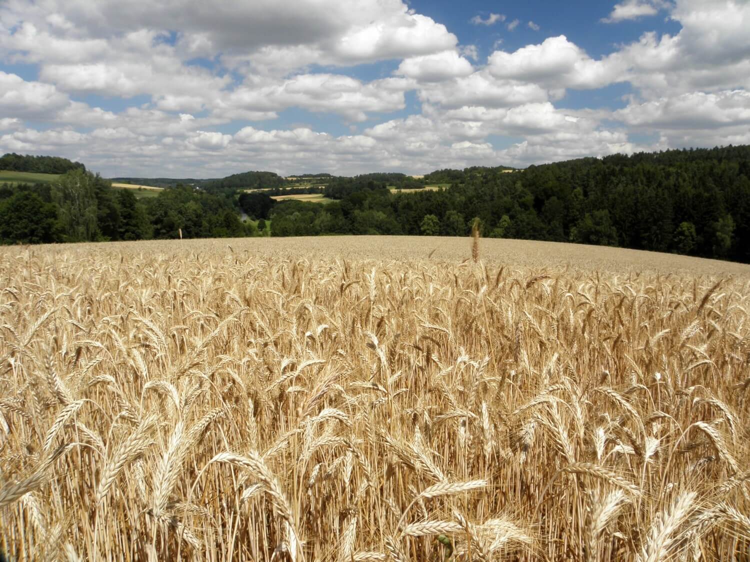 We started with the search of the map. For this reason we drove into a town and stopped at a petrol station. With a map in hands, we drove a little farther and stopped for a coffee, some cake and working out a plan of our journey through Germany. At the beginning we found several scenic routes through very nice area: fields, forests and towns. The sun shone and it was going very well. It was so nice that we decided to stop once again for coffee and some cake.
Shortly after that we got onto the motorway to bypass Frankfurt. It was supposed to be quick, but unfortunately because of the road works and quite heavy traffic we were moving slowly. It was already past 18.00 when we left the motorway, to get onto the road no. 42 to drive along the Rhine. This road runs along the river, actually you can go on both sides of the river, and from time to time are ferry crossing to the other side. Cities and towns beautifully fit into wooded slopes of hills surrounding the river. On the slopes there are also many vineyards and charming castles. The views were spectacular and drive was superb, if not only for one thing: we were driving against the sun, which significantly made our drive difficult. Thus, at the earliest opportunity we got across the river to drive on the shaded side. However, as the river winds its way at the entire length, sometimes the sun would come out.
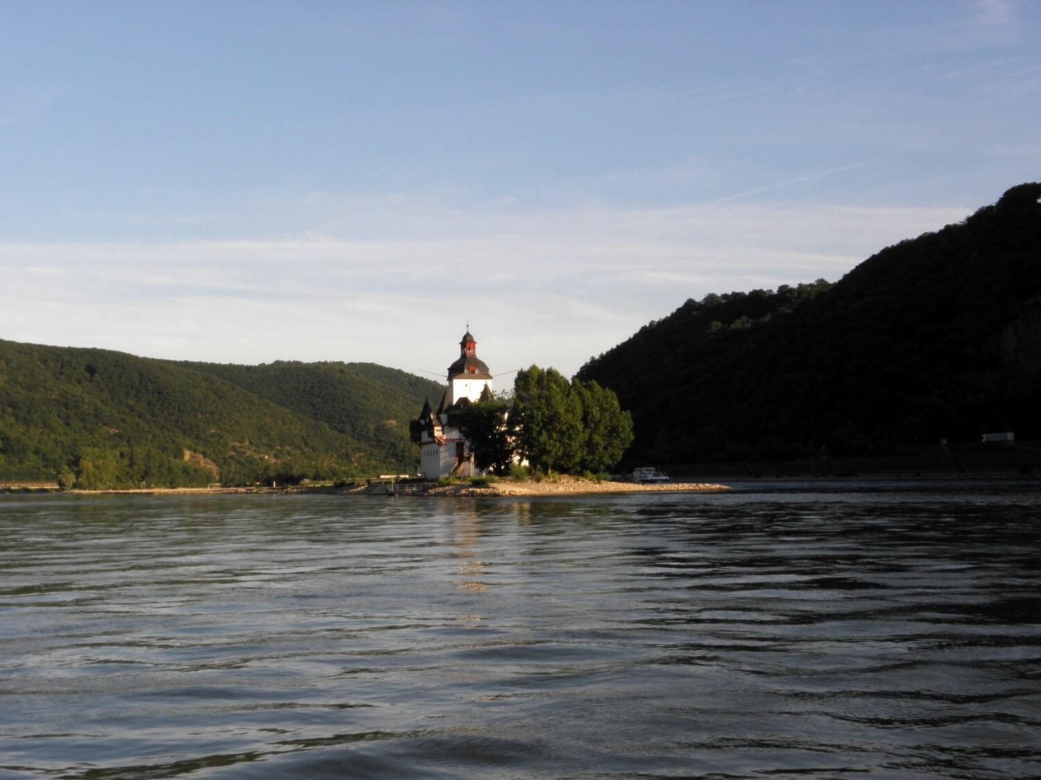 There is an incredible traffic here, both on the river, on which tankers and passenger ships sail, and on the roads on both sides of the river. More, there is the railway line, where every now and then trains pass by, both passenger and freight.
We passed many camping sites along the way, quite large they were. We got to Boppard and there we decided to stay. We had a little trouble finding a space for a tent, it was so crowded there: caravan next to caravan, tent next to tent – craziness. After setting up the tent we quickly went to the restaurant for a late dinner. It got very pleasant, because we ate outside, right on the banks of the Rhine, while enjoying the sunset and the rise of the full Moon. It got quite late, so we took a quick shower and went to sleep
GERMANY:
– very well marked roads, both the main and the side ones; the best quality of all the countries we have visited so far
DAY 22. ON THE WAY BACK
Boppard, Germany –> Ashby-de-la-Zouch, England (555 miles)
As the traffic both on road, on water and railway did not stop all night, it was quite loud and I was waking up every now and then. To our surprise the tent was completely dry despite the fact that we slept right by the river. We packed up swiftly and at 8.00 we went to breakfast which we booked in advance. We had to wait for it a bit, but we managed to leave the campsite just before 9.00. Following the side roads we got across to the motorway, yet admiring on the way the Rhine, seeing it from the top.
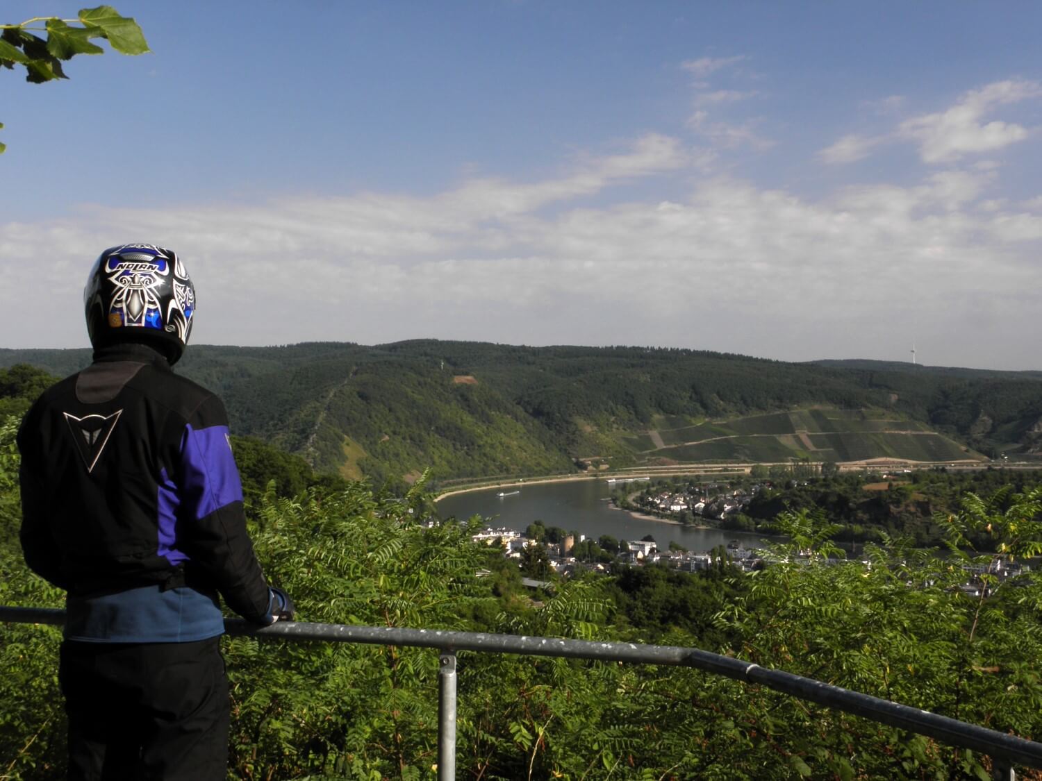 We moved on the motorway just a short distance, leaving at Mayen junction, onto the road no. 258, which we wanted to drive to Aachen. The road nicely wound through the German lands, among the pleasant to the eye landscapes with fields, forests and charming villages. It was a very pleasant drive. We stopped for a coffee and delicious cakes at small backyard café, the sun was warming us up, we could relax completely.
Lots of motorbikes were driving in that area, in general I would say that the traffic was heavy, I’m not sure whether because of the weekend or the fact that we were driving a popular route. Overall, it was busy on the roads.
Just before Aachen we got onto the motorway and we have taken the easiest direction to our home, through Brussels, Gent and Calais. It was surprisingly warm and the drive was comfortable and quite smooth. We arrived at Calais just before 18.00. We bought a ticket for the ferry at 19.00, but despite long queues at passport controls, we were able to get onto the earlier ferry, as it was slightly delayed. When we drove off the ferry it got quite chilly, but we moved at once in the direction of setting sun, which unfortunately was not very pleasant, because it simply dazzled us. Already in the dark we stopped to refuel and to warm ourselves up with hot chocolate. We put additional layers of clothing, as with every moment it was getting colder.
We got home around midnight. Quick shower… and how nice it was to lay down in a comfortable bed:)