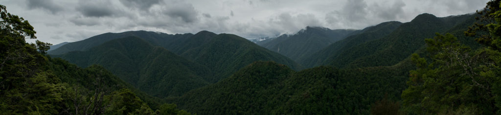
Kahurangi National Park is the New Zealand’s second-largest national park. In the Maori language, Kahurangi means ‘treasured possession’, which explains its diversity of land forms, native plants and unique species of birds. Much of the area is untracked wilderness with exceptional landscapes, the oldest rocks, shafts and sinkholes, remote river gorges, alpine herb fields and tussock plateaus.
Finishing Abel Tasman Coast Walk we found ourselves at the gates to the Kahurangi National Park. Our natural choice was to cross the park and get to the West coast, the question was how. We spend one night in Takaka, where we looked at the maps and planned our next walking trip. There are few tracks in the area, we combined some of them (Upper Takaka Track, Starvation Ridge, Leslie-Karamea, Wangapeka) and created route that would take us to the other side of the National Park. Then everything happened quickly. We woke up, packed up, walk to the shop and made food supplies. One more task left to do, get to Upper Takaka, where our route stared. We head out of town, walk a bit, and luckily quite quickly we managed to hitchhike. As a result, at about midday we were ready to start our walk.
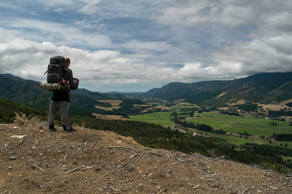
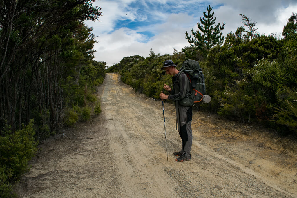
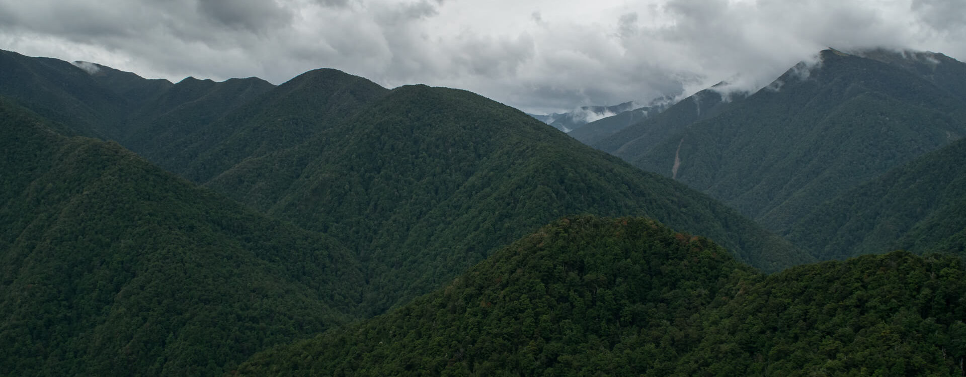
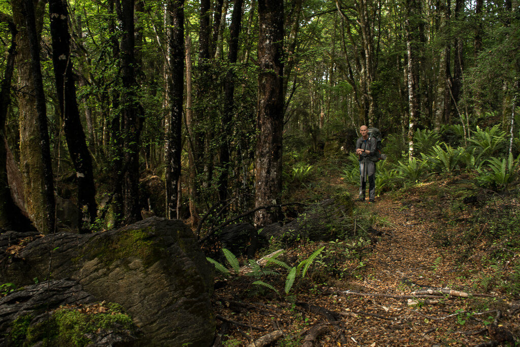
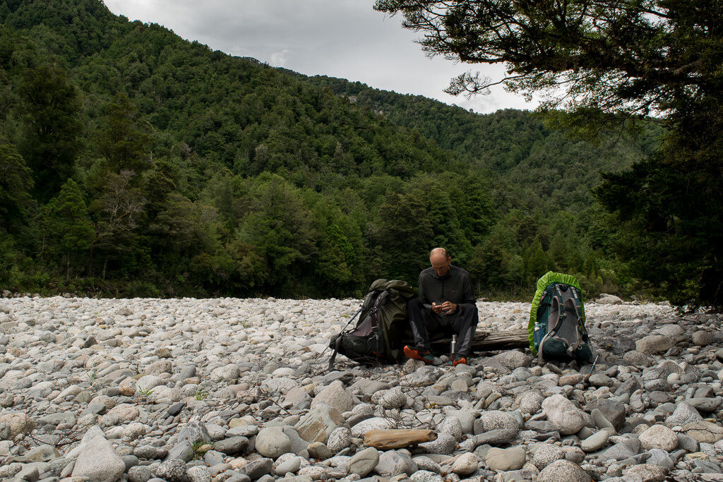
The day got hotter with every hour, and we had some climbing to do. Just before it, we found small stream and stopped for dinner. It proved to be a good decision, as later there was no water until we reached the forest in the evening. We were following dirt road for most of the day, it wasn’t so steep, but steady up, higher and higher. We started on the meadow valley, but soon we were above it and had incredible views of the valleys and green hills around. There were wasps in the area; all we could hear around when we stopped was constant buzzing. Fortunately for us, they weren’t aggressive, we just had to be aware of them. When the late afternoon came, we realized we might have problems finding place to sleep. As our luck goes, when we start looking for something it’s nowhere to be found, yet during the day we saw plenty spaces ideal for camping. It was still too far to any hut, and we were surrounded by dense bushes. From the dirt road we got onto a path, which lead over slopes that were too steep for tent. In the evening the path crossed over flatter terrain, close to one of the rivers. We managed to find a piece of land, just big enough to fit our tent. It was so peaceful and quiet, only the sociable robins were interested in what we were doing.
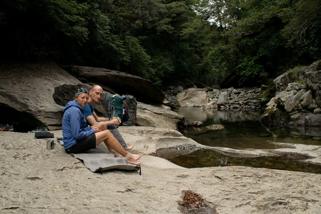
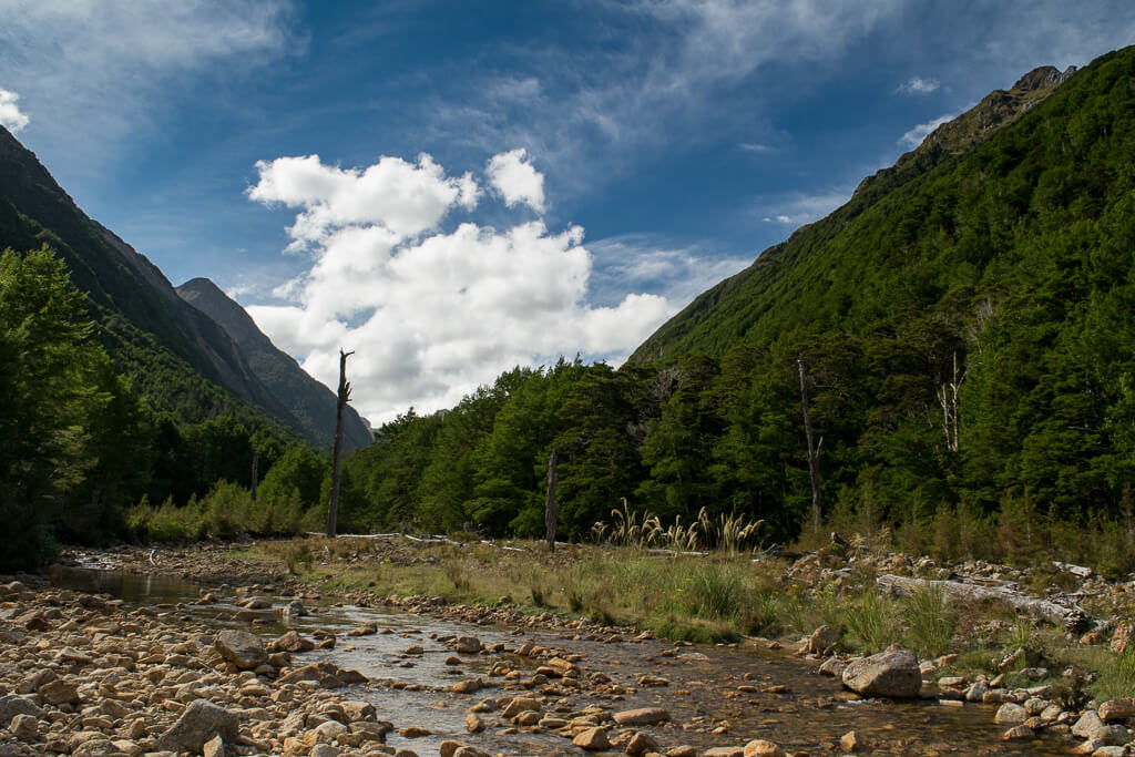
Next day, after the breakfast by the river, we started slow ascend on a path leading through forest. For the coffee break we found one of the best spots, a big rock in the middle of the river. We were able to get there as the water level was quite low, and we had very nice time over there. Later on we met group of people on their short walk and one cyclist, and they were only people we met on that day. When we got to the natural rock shelter, we stopped for the dinner. It started to drizzle at that time, but it was quite warm, so we did not put raincoats on. Soon the landscape changed, the path get us out of the forest and over the tussock clearings and through lichen-covered trees we reached the Tableland plateau, the highest point on the Leslie-Karamea track. Then we started descending back into the woods. As it was drizzling the path became slippery, and we had to take more care when walking. It was late afternoon when we got to the Splugeons Rock Shelter, basic 5 bunk shelter. It was so nice over there that we decided to stay for the night. Next shelter was too far and there was more rain coming according to the forecast. We had peaceful evening with superb view. The drizzle turned into proper rain. It rained all night, disturbing our sleep as the raindrops falling onto the roof made so much noise. We even considered staying another day in the hut if the weather would be bad.
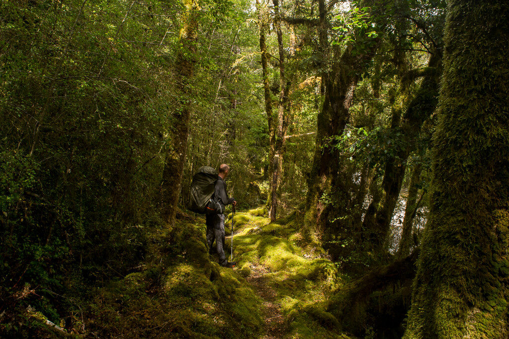
It was still drizzling in the morning, but not so much, so after lazy breakfast and tea we packed up and moved on. We continued descending and soon we reached Leslie River which we were then following for some time. The landscape changed again and now we entered fairy-tale like forest with trees covered in moss and lichens and water damp understorey. In the early afternoon we arrived at the Karamea Bend Hut, where we had our dinner. It was so good to be able to sit inside, as the sandflies were very aggressive that day, making it almost impossible to sit outside. The path started following Karamea River. We still had few kilometres to the next hut. From the map, the path looked like an easy one, just stroll along the river, but it wasn’t so. Walking was slow, as the path was narrow in places, leading through rich ferns, vines and shrubs, with roots sticking out, over the river terraces, across and along the river beds, and after the rain everything was wet and slippery. When we got to the Crow Hut, it was early evening. We stayed for the night in the hut, where we joined family of four and a fisherman. While taking quick bath in the river we were badly bitten by sandflies and “attacked” by eels which we hadn’t expected at all! We had nice evening chatting and relaxing and trying not to scratch ourselves through to the bones.
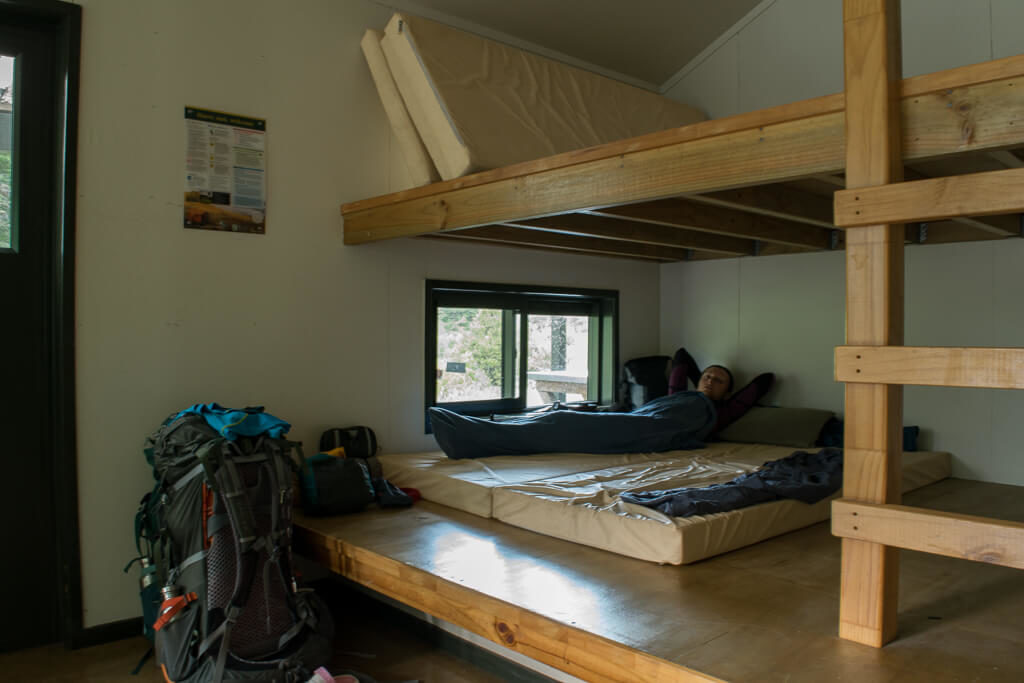
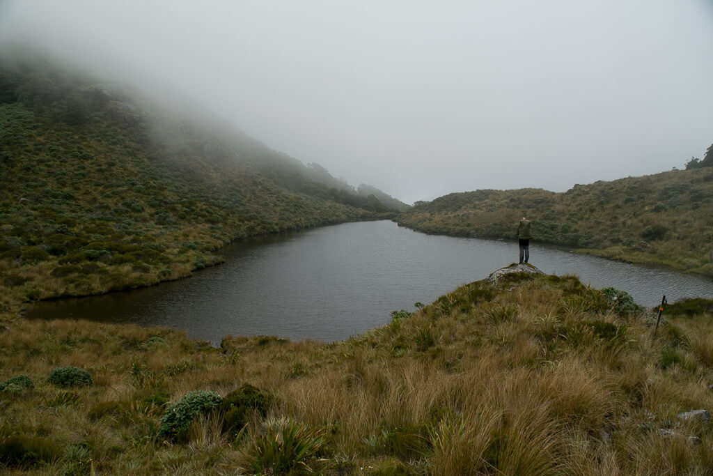
Beautiful morning sun woke us up and after a nice breakfast we continued walking along the Karamea River, mainly over forested terraces. At lunchtime we stopped at Venus Hut and had coffee break. Then we continued along the river, sometimes walking over the riverbed, sometimes on cliffs above the river. These all slowed us down and it took so many hours to get to next hut as the signpost promised. We had dinner at small and old Thor Hut. The day was still young, so we decided to carry on to the next hut, which was 10 kilometres away. We crossed many earthquake-triggered slips which slowed us down, but the path itself was very nice. We walked along Moonstone Lake formed by one of the slips and almost 3 kilometres long with naked trunks of trees drowned during lake formation. Instead of walking all the way to the bridge, over and then back to the hut, we took the shortcut and as the water level was low we crossed the river and walked straight to the hut. We expected to meet people at that hut, as we were very close to the Wangapeka Track, but there was no one. Nice 12 bunk hut located by the river in a beautiful valley just for us, it was one of the best spots we stayed in. We had quick bath in the river, and then we could enjoy rest of the evening admiring the views.
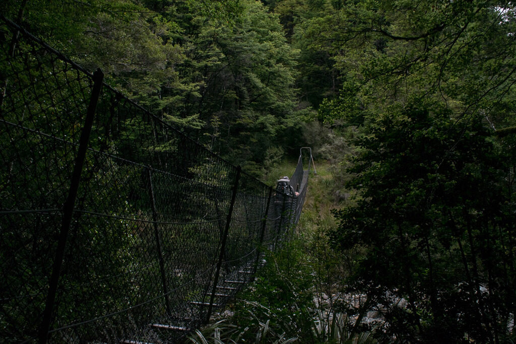
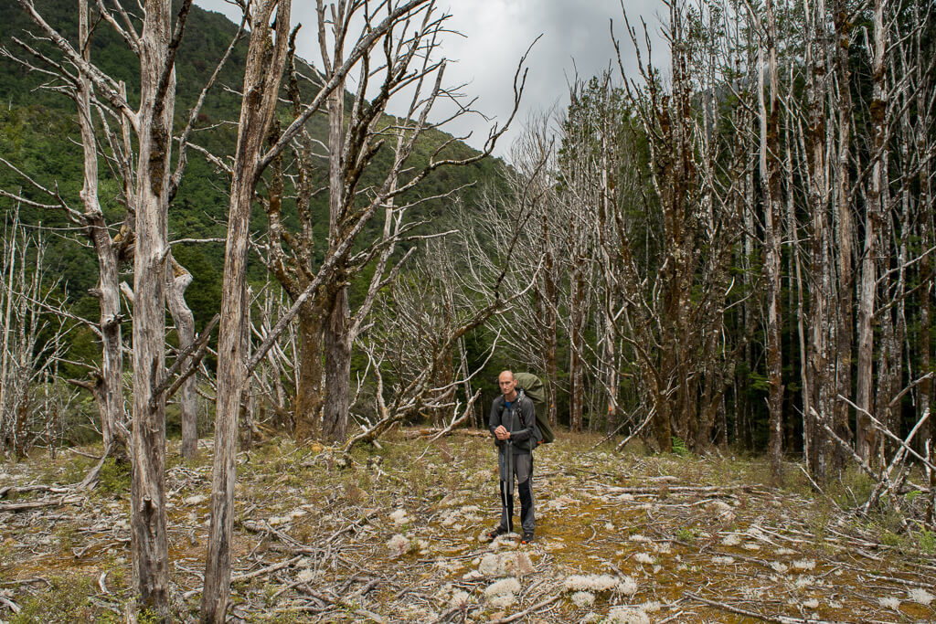
It would be nice to stay another night, but we decided to move on. We crossed the river via the bridge and soon we reached Taipo River and got onto the Wangapeka Track. The path was winding through red and silver beech forest along beautiful valleys. We arrived at Taipo Hut just in time for dinner. The route then got gradually steeper and took us steeply up to the Little Wanganui Saddle, the highest point on the Wangapeka Track. We climbed it quicker that the signpost stated, even though we had heavy backpacks on. It got cloudy and cold on the top, so we did not stop for long and continued our walk. We passed the Saddle Lakes and then started going steeply down to the Little Wanganui River. When we got down, we considered staying in the small Bivvy shelter, but as there was only about 5 kilometres left to the Beltown Hut, so we thought we will manage to get there quicker, just as we quickly crossed the saddle. After quick snack, we carried on walking. It proved to be the longest 5 kilometres of this trip. The route was narrow and winding, with roots and shrubs slowing us down. Part of the route was destroyed by the slips and there were diversions made, so we had to negotiate many difficult sections with upturned trees and it all took much longer than expected. It was getting dark when we arrived at the Beltown Manunui Hut. Tired, but happy that we managed to pass this section, we settled for the night.
We slept well and did not hurry in the morning to get up. The last part of the track was an easy walk over grassy flats to the Wangapeka Road Car Park where our route has finished.
Walk through the Kahurangi National Park was an amazing experience of wilderness in its best sense. River valleys with forested hills around with abundance of wildlife and vegetation create perfect destination for people looking for peaceful and remote places. The area is great for tramping, mountain biking, rafting, caving, wildlife watching and fishing.